


Leica Pegasus:Two Ultimate Mobile Sensor Platform
Seamless 360-degree imagery calibrated to the point cloud for improved smart city applications

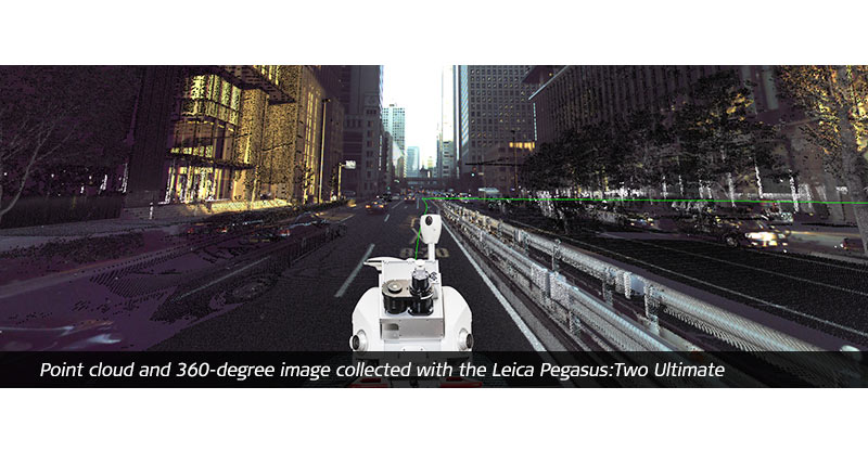
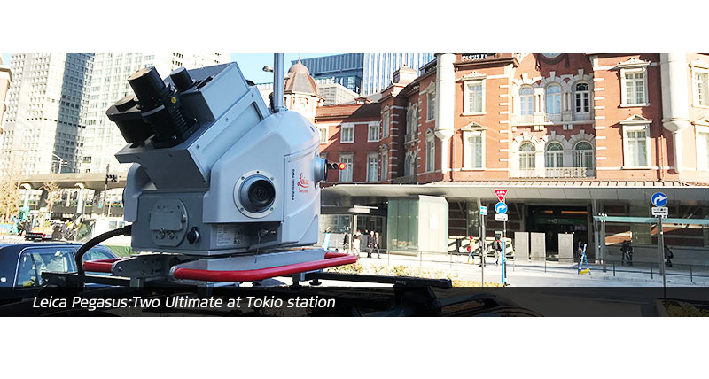
The Leica Pegasus:Two Ultimate is the updated version of the Pegasus:Two, Leica Geosystem’s trusted mobile mapping platform, and removes the need for six camera stitching by incorporating two back-to-back cameras creating a 24 MP 360-degree image calibrated to the LiDAR profiler data, enabling digital reality captures from car, train, or boat. To enable faster processing at the office, a removable SSD allows to simply eject your data and walk into the office.
The new Leica Pegasus:Two Ultimate increase your working day - allowing capture in a variety of lighting conditions and vehicle speeds - a higher dynamic range is enabled by a large sensor to pixel ratio and a dual-light sensor. Photogrammetry and image quality is improved with the increased side camera resolution of twelve mega pixels and onboard JPEG compression.
Compared to the Pegasus:Two, front and rear cameras are removed as the photogrammetry measurements offered from these positions are not needed in the upgraded system due to the geometry of the possible stereo pairs.
- Side cameras deliver 8.0 FPS at 12 MP, each side camera provides 61° x 47° FOV
- Maximum pixel size at 10 m is 3 mm
- Adjustable pavement camera with 12 mm lenses, enables targeted image capture along a road or in a tunnel
Data download
The spatial data store allows you to find and order imagery as and when you need it. Define the search method, projection, coordinate system, resolution and output file format. Within minutes your exact specified imagery can be downloaded. You can purchase imagery by credit card or apply for a business account.
Streaming service
Stream imagery using protocols like OGC WMS and WMTS directly into your application of choice, including Esri, MapInfo, Global Mapper and all proprietary oil and gas applications. Subscription fees include unlimited viewing and plotting. To learn more or receive a quote, contact our authorised resellers.

Pegasus:Two Ultimate and IDS Stream UP solution
Pegasus:Two Ultimate and Stream UP systems can be easily combined to deliver synchronised data acquisition of Ground Penetrating Radar, LiDAR and camera intelligence with a collection speed of up to 60 km/h. This integrated solution enables the accurate reconstruction of geospatial assets above and below the ground. Find out more here.

Leica Pegasus:WebViewer
Discover the new browser-independant sharing platform for data captured with Leica Geosystems mobile mapping sensors

Contact us about Mobile Mapping Solutions
Get in contact with us for more information about our mobile mapping solutions.

Stories & Insights
Discover how mobile mapping technology enable our customers to regularly capture and digitise changing environments in 3D.

Reality Capture Blogs
Discover how our reality capture portfolio transforms data into real-world action.

Contact our Public Safety, Security and Forensics experts
Peer-to-peer advice from experienced Public Safety experts
Peer-to-peer advice from experienced Public Safety experts