


Our reality capture, measuring and positioning solutions provide actionable data to support rigorous scientific study methods.


Explore our wide selection of on-demand webinars and register for upcoming webinars in our Laser Scanning Webinar Hub.


A long-term topographic survey and monitoring project on one of the largest and most extraordinary glaciers in the Alpine region - the Gorner Glacier.

NIVA (Norwegian Institute for Water Research), an environmental research institute for water-related issues, uses Leica Geosystems GNSS equipment in an exciting multi-year research project

Deploying 3D Terrestrial Laser Scanning and Mobile Mapping solutions, resulting in the first ever 3D replica of the largest lava tube on Earth.

Laser scanning technology supports the creation of an interactive 3D model of a cave inside the world-famous Perito Moreno glacier in Argentina.

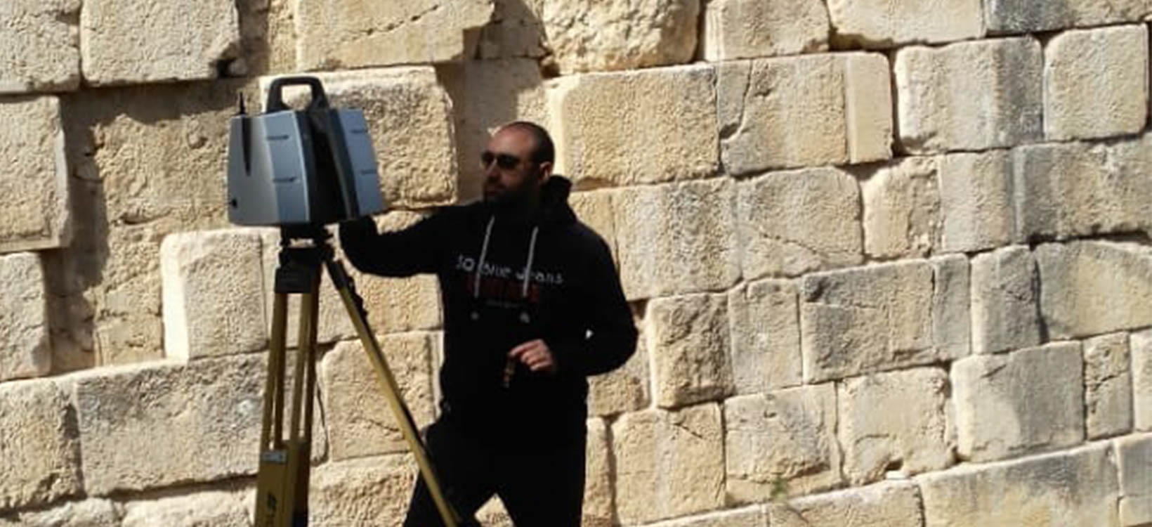
Digitally documenting an important archaeological site and one of the largest ancient mosaics in the world with laser scanning technology.

Geographic agency Vigea, used Leica Geosystems laser scanning technology to capture the ‘Tana della Mussina’ cave.

3D models help researchers to understand geological processes in Chile and Italy.

High-definition 3D mapping specialists Visualskies provide a bespoke 3D scanning service for a ground-breaking new TV series for National Geographic.

Experts from ETH Zurich create digital terrain models from hydraulic models using laser scanning technology to optimise river planning and flood prevention in the Alpine Rhine in Switzerland and Austria.

3D laser scanning and GNSS sensors were used to generate data to study and manage a 6,298-metre cave in Romania

Using laser scanning technology to digitally reconstruct a medieval water clock in Morocco

Mexican archaeologists use laser scanning to restore a pharaonic tomb dating back to 1500 B.C. in Egypt

Documenting digitally Malé Hukuru Miskiy and its exceptional coral stone carvings in the Maldives

3D laser scanning of Nefertari´s tomb to safeguard cultural heritage in Egypt

Using Micro Pulse LiDAR, researchers at the Atmospheric Radiation Measurement on the remote island of Ascension collected data to understand how biomass burning airborne particles impact the climate
Transforming the ancient Bacchus Temple in Lebanon into a 3D digital model

In the quest for finding hidden chambers in Tutankhamun’s tombs with Ground Penetrating Radar in Egypt

Merging traditional archaeological tools and methods with the use of geospatial technologies to unveil the secrects of Motya island in Italy

Geosystems’ innovative GNSS technology transforms archaeology in Kyrgyzstan

Producing the largest 3D scan of a lava tube in the Spanish island of Lanzarote.

Creating a 3D model of ancient stone towers and its surrounding area in Russia.

Creating a new digital map of Britain’s most important archaeological monuments using a high-tech approach.

Interferometric radar for safety in critical ice avalanche monitoring in Switzerland

New Zealand's most extensive GNSS reference station network with more than 70 stations nationwide.
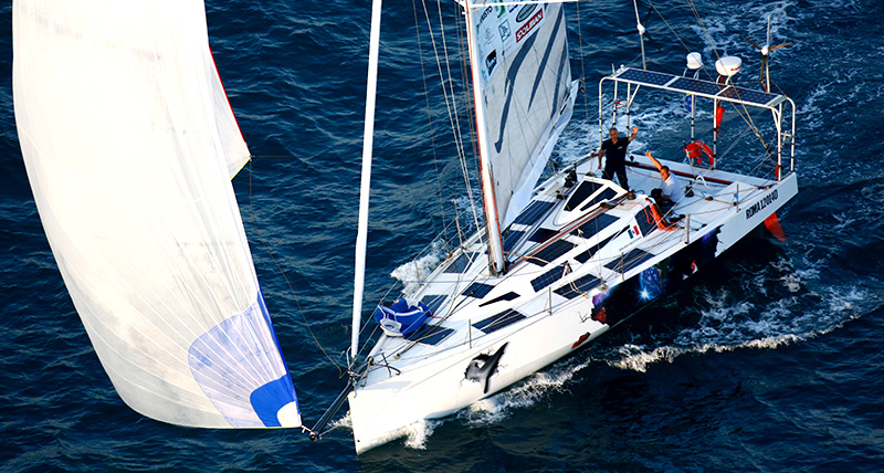
ECO40 boat trip research to providing ocean scientific information

Hydrologic research using Leica Geosystems GNSS solutions to measure the impacts of a changing climate in the Canadian Arctic

Using an UAV to measure the depth of a lake in Switzerland

Laser scanning for historical documentation in Uzbekistan

Underground survey for archaeological artefacts using Ground Penetrating Radar in the United Kingdom

Lidar technology uncovers Cambodia's ancient cities.

Revealing the secrets of an archaeological ensemble with laser scanning and the Pegasus:Backpack.

Laser scanning plus tracking for historical documentation in Turkey

Learning to preserve historical and architectural heritage in India at an International documentation workshop
