


10 reasons to get the new ScanStation P-Series firmware

The new firmware v2.70 for the ScanStation P-Series will be available at the end of April.
Leica Geosystems announced and showcased the new firmware v2.70 for ScanStation P-Series at SPAR 3D this week, and the reception was "extraordinary" according to Juergen Mayer, Leica Geosystems business director, Terrestrial Laser Scanning, Geomatics Division.
Based on user feedback, v2.70 is part of the ongoing firmware improvement process that incorporates several new features specifically asked for by customers.
Here are the top 10:
- Range extension for the ScanStation P16
- Mark detail scans in Scan Viewer
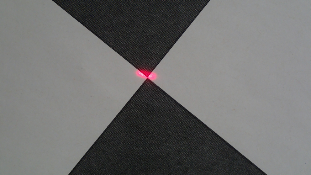
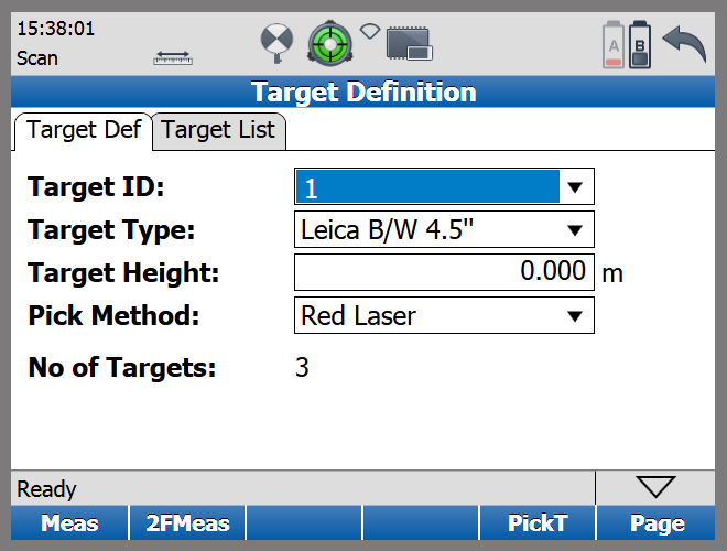
- Target picking with red laser
- Display brightness adjustment for improved readability
- Target scanning in zenith direction
- Imaging now available for Detail Scan function
- Automatic wake-up sessions for monitoring solutions
- P-Series Simulator
- Customised Intensity Mapping
- Export Control Points
Maximum measurement range for the P16 has been increased from 40 m to 80 m. At the same time the highest resolution was also doubled from 1.6 mm to 0.8 mm at 10 metres.
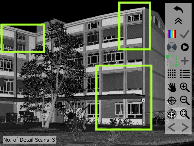
Detail scans in the Scan Viewer are marked with a frame around the scan area for a better identification.
In addition to the picking options “scan” and “video”, targets can now also be picked with the red guiding laser. This new feature works very well with shorter distances and is of great benefit in tunnelling applications with poor light conditions. The target is picked by just moving the red laser beam manually.
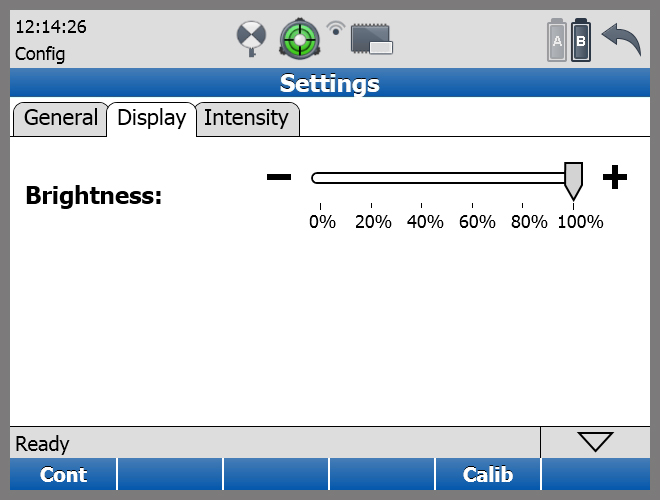
The on-board display now supports brightness adjustment for better readability at low light conditions.
Targets can now be acquired in the zenith direction of the instrument, which helps to geo-reference the instrument in shafts, may it be elevator shafts in upright position or manholes for canalisation in headfirst position.
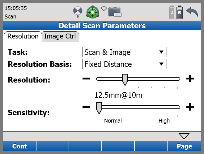
Based on user feedback the popular Detail Scan function was enhanced. It allows to define limited areas, which shall be scanned with a higher resolution than the rest of the scan. This function has been enhanced with imaging. The user can choose between "Scan only", "Image only" or "Scan & Image".
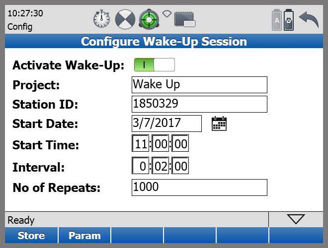
The instrument can now start to acquire data automatically. Pre-sets for date and time as well as for interval and number of iterations allow for a recurring scanning of an object without further user interaction required. This function can be used for monitoring tasks, for example.
The P-Series Simulator has been significantly enhanced. Up to five scanners can be connected. The remote computer works like a server, which stores scan data of all connected scanners simultaneously. All results are available immediately. This feature is also ideal for fixed monitoring installations.
Intensity Mapping can now be customised with individual colour schemes. Customisation can be done on the desktop with the new P-series Intensity Map Editor. Custom intensity mapping settings can then be uploaded to one or more instruments. As a result, scans from different scanner models (e.g., C10 and P40) can be combined to a point cloud with consistent intensity colouring.

Right image: Default intensity colouring, Left Image: Modified colour scheme
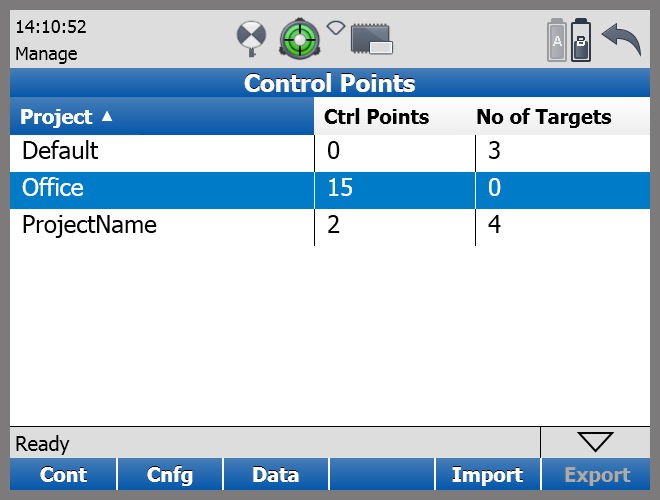
Control points can be exported as a CSV file to an attached USB storage device. As an option targets can be added to the export.
The new firmware is compatible with all P-series scanners and can be used by all customers with a valid CCP contract. All new scanners will be delivered with v2.70 firmware installed.
To pre-order the new firmware, contact your local Leica Geosystems representative today.

Case Studies
Read how customers from around the world are putting our diverse solutions into action to shape smart change.
Read how customers from around the world are putting our diverse solutions into action to shape smart change.

Contact Leica Geosystems
Find your Leica Geosystems contact for sales, support and technical service.
Find your Leica Geosystems contact for sales, support and technical service.