


Leica Nova MS60 – The World’s First Self-Learning MultiStation
The new experience in measuring technology

Monitoring a busy UK highway during rail construction
Automated laser scanning with the Leica Nova MS60 made it possible to continuously monitor a low access, high-traffic motorway.

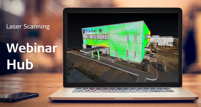
White Paper: Leica Nova MS60
Discover how sensor fusion can help you master your projects.

MS60 Webinar: Multi-talent for every application
Learn from an expert how the Leica Nova MS60 scanning total station improves productivity in daily tasks and challenges.
To meet the demands of our ever-changing and increasingly-quicker world, we developed the world’s first MultiStation, combining all available measurement technologies in one superior instrument. Now, we’ve made that instrument even smarter. The Leica Nova MS60 MultiStation is the world’s first self-learning MultiStation, automatically and continuously adapting to any environment, despite any challenges.
Scanning with the Leica Nova MS60 has been made simpler through the instant creation of point clouds with overlaid measured points and 3D models in one view. Visualisations are clearer and easier to see on an all-new 5” screen.
The unique capabilities of the Leica Nova MultiStation truly deliver the new experience in measuring technology.
Nova MS60 MultiStation also comes with:
Engaging software
The Nova MS60 MultiStation comes with the revolutionary Captivate software, turning complex data into the most realistic and workable 3D models. With easy-to-use apps and familiar touch technology, all forms of measured and design data can be viewed in all dimensions. Leica Captivate spans industries and applications with little more than a simple swipe, regardless of whether you work with GNSS, total stations or both.
Infinite possibilities
While Captivate captures and models data in the field, Leica Infinity processes the information back in the office. A smooth data transfer ensures the project stays on track. Captivate and Infinity work in conjunction to join previous survey data and edit projects faster and more efficiently.
Customer care at a click
Through Active Customer Care, a global network of experienced professionals is only a click away to expertly guide you through any problem:
- Eliminate delays with superior technical service
- Finish jobs faster with excellent consultancy support
- Avoid costly site revisits with online service to send and receive data directly from the field.
Control your costs with a tailored Customer Care Package, giving you peace of mind you’re covered anywhere, anytime.
Customisable packages
A portfolio of intuitive software for any application gives you the freedom to choose how you want to work. Leica MultiWorx for AutoCAD, Leica Cyclone, Leica GeoMos, Leica Infinity, various Hexagon software packages and selected partner third-party software can be integrated into your workflow to create the customised solution for your specific need. Whatever you choose, you’ll enjoy an immersive experience that goes well beyond the data.
Dynamic Lock
The new Dynamic Lock functionality has greatly improved the lock-on capability of ATRplus in the Nova MS60 MultiStation. Get better performance with the larger search area for locking onto a moving target. The MultiStation can be used in standard surveying or high-dynamic machine control applications.
Watch the tutorial video and learn how to use the Dynamic Lock functionality.

Highest-end total station
Highly accurate angle and distance measurements, robust design and easy-to-use apps. With improved automated functionalities, like Dynamic Lock and Autoheight, and the self-learning ARTplus features, the MS60 increases your efficiency, even in the most challenging conditions.
Highly accurate angle and distance measurements, robust design and easy-to-use apps. With improved automated functionalities, like Dynamic Lock and Autoheight, and the self-learning ARTplus features, the MS60 increases your efficiency, even in the most challenging conditions.
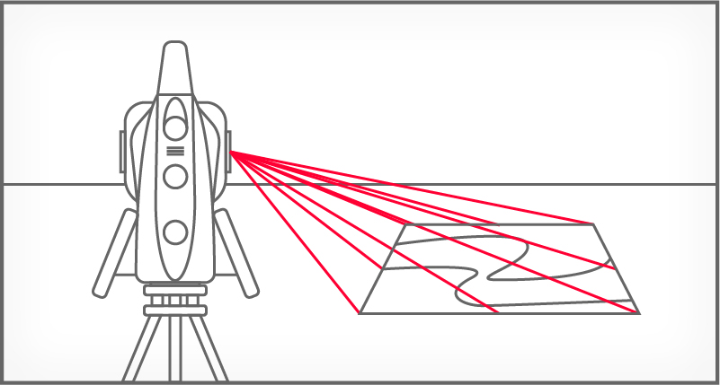

3D laser scanning
Scan up to 30,000 points per second (Hz) to complete your work quickly and get dense scanning grids. The MS60 features optimised scanning paths, including zenith scans, allowing you to significantly reduce the total scanning time.
Scan up to 30,000 points per second (Hz) to complete your work quickly and get dense scanning grids. The MS60 features optimised scanning paths, including zenith scans, allowing you to significantly reduce the total scanning time.
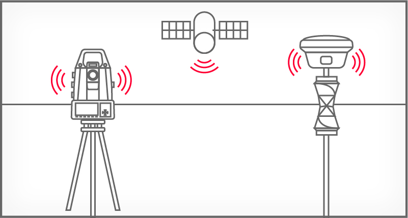

GNSS connectivity
GNSS is fully integrated in the workflow and the data structure, enabling direct georeferencing and increasing your flexibility in the field.
GNSS is fully integrated in the workflow and the data structure, enabling direct georeferencing and increasing your flexibility in the field.


Digital imaging
Digital imaging technology, including an overview and a 30x magnifying telescope camera, enables accurate image-assisted surveying both at the instrument and remotely, while also including extended image documentation.
Digital imaging technology, including an overview and a 30x magnifying telescope camera, enables accurate image-assisted surveying both at the instrument and remotely, while also including extended image documentation.

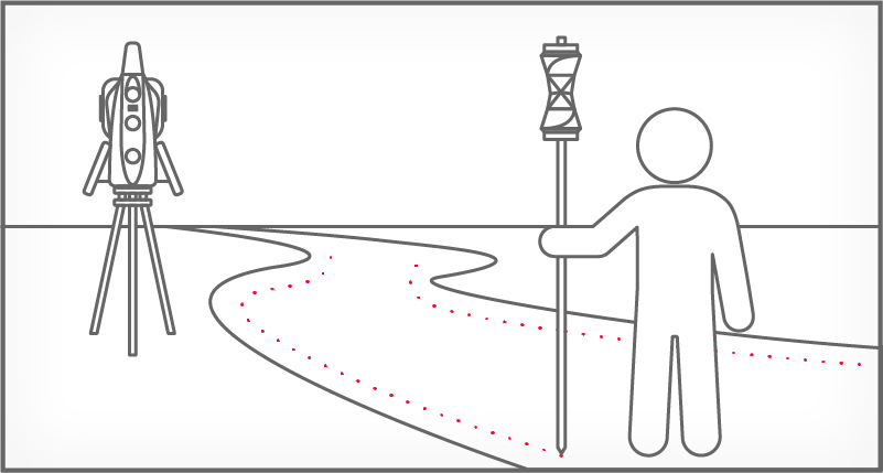
When to use the Leica Nova MS60
Traditional surveying and so much more. Learn ways our scanning total station enables measurement tasks and deliverables for a range of sites and structures.
- Surfaces and volumes in construction and mining, soil heaps and stockpiles, DTM creation and checking surfaces, material thickness, blast faces and ground levels
- Analysis of complex structures and objects within plant, marine and utility projects: dimensional control, as-built and record keeping
- Measuring buildings and structures: bridge condition/clearance analysis, BIM and as-built
- Facade, elevations and heritage work: creation of traditional deliverables like 2D maps or 3D models
- Deformation monitoring of structures and ground: automated or periodic measurements of buildings, transportation infrastructure, natural hazards, dams and other objects

Integrated surveying, monitoring and CAD software
- Leica Captivate - the MS60’s onboard software with easy-to-use apps that cover all your surveying tasks. Includes a range of tools to optimise scanning tasks, like the Inspect Surface app and more.
- Leica Infinity - an intuitive surveying office software enabling seamless data transfer from the MS60 to the office to manage, process, analyse and quality check your field data.
- Leica GeoMoS - the automated deformation monitoring software providing movement analysis, reports and notifications
- Leica Cyclone - point cloud processing, management, collaboration and visualisation software.
- Leica Cloudworx - CAD plugins that allow you to work efficiently with large point clouds directly in your chosen CAD system
- Additional Hexagon packages and selected partner software

Featured Content

Highway monitoring enabled by patch scanning
The MS60 was an integral tool for monitoring a busy UK highway during tunnel construction underneath. Using the unique patch scanning feature and monitoring software, drivers could use the roadway while monitoring for movements ensured their safety.
The MS60 was an integral tool for monitoring a busy UK highway during tunnel construction underneath. Using the unique patch scanning feature and monitoring software, drivers could use the roadway while monitoring for movements ensured their safety.

Innovations to the MS60
Learn how the MS60 scanning total station integrates the latest technologies to improve measurement potential across a broad range of applications from one our experts.
Learn how the MS60 scanning total station integrates the latest technologies to improve measurement potential across a broad range of applications from one our experts.

The payoff of a scanning total station
Successful U.S. company Titcomb Associates shares their experience integrating the MS60 into surveying workflows and the resulting safety and business benefits.
Successful U.S. company Titcomb Associates shares their experience integrating the MS60 into surveying workflows and the resulting safety and business benefits.
Leica MS60 MultiStation is fully compatible with:

Leica Captivate
Leica Captivate is a customisable, user-friendly surveying software that handles measurement tasks with precise 2D views, 3D models, and intuitive apps for data collection, visualisation, and sharing.
Leica Captivate is a customisable, user-friendly surveying software that handles measurement tasks with precise 2D views, 3D models, and intuitive apps for data collection,...
Leica Infinity
In Infinity office software, combine and manage all your survey data from a range of sensors with precise processing tools, 3D visualisations, and efficient collaboration and delivery workflows.
In Infinity office software, combine and manage all your survey data from a range of sensors with precise processing tools, 3D visualisations, and efficient collaboration...


MS60
Innovations to the Leica Nova MS60 Scanning Total Station
Leica Nova MS60 – Dynamic Lock
Related Topics
Increase Surveying Productivity through Imaging and Augmented Reality
Digital Interoperability Between Leica Infinity and Leica Cyclone
Just a Sticker? The Value Behind Certifying Your Measurement Instruments
The emergency services and the public entrust us with their lives
Volumes
Clash detection
Topography and as-built-check
Tunneling
Mining
Deformation monitoring
 Training videos
Customer Stories
The Not-So Surprising Secret to Running a Successful Surveying Firm
Adding Real Customer Value with the Leica MS50 MultiStation
Case Studies
Innovating As-Built Verification
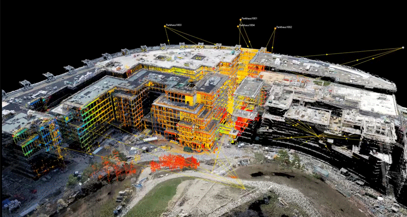
Monitoring with the MS60
Learn how the MS60 has been incorporated into comprehensive and automated monitoring solutions on projects across the world.
Monitoring Dublin Commuter’s Safety
Scanning High-Traffic Roads Unmanned
Slope Movement Monitoring at Hinkley Point C
Legacy Cases
While MS60 technology has progressed since these cases first came out, they continue to inspire with what MultiStation technology can achieve on outstanding projects.
Lift-off with MultiStations, Robotic Total StationsReturn to the High-Definition Surveying Seas
Scan of the Mont Blanc Ice Cap