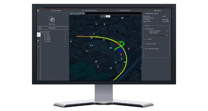
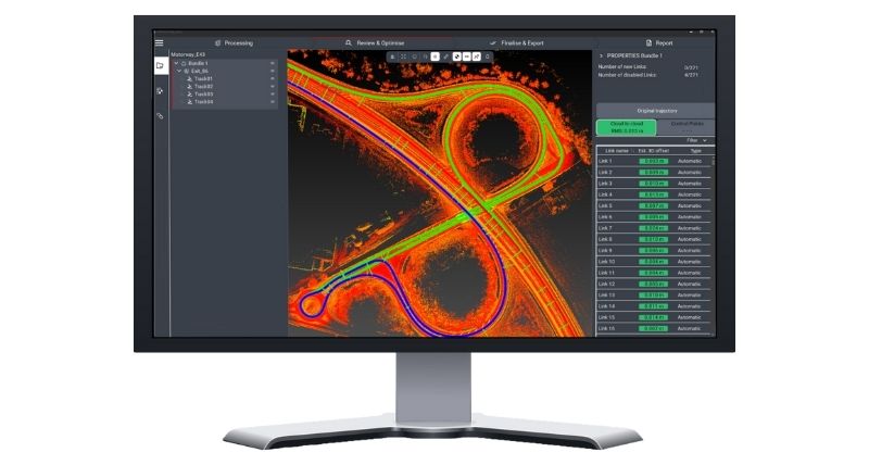
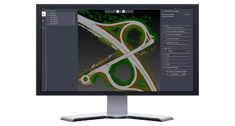
Leica Pegasus OFFICE
Mobile mapping office software for high-precision data processing and publishing
Leica Pegasus OFFICE is the mobile mapping software that transforms raw data into high-value deliverables, including geo-referenced, photo-realistic point clouds. These outputs provide clients with detailed, accurate insights into captured data.
Features such as AI-assisted segmentation, blurring identifiable data for anonymisation, and automated track linking accelerate workflows and ensure seamless processing. Pegasus OFFICE leverages all positioning information for digital-twin-ready deliverables and features guided workflows for a user-friendly experience from processing to publishing.
Process
Once data is captured in Pegasus FIELD, simply open the acquired project in Pegasus OFFICE to start trajectory processing. Simplify processing with suggested profiles and tools that assist in organising point clouds and images, transforming data into high-quality deliverables.
Review and optimise
Georeference your data with built-in intelligence that optimises and adjusts trajectories, point clouds, and images. The software automatically links data across passes and tracks, allowing users to review and validate adjustments before proceeding.
Finalise
Export point clouds, images, and customised reports in multiple formats for a variety of applications, from smart city modelling to infrastructure surveys and HD maps. Flexible export options let you select which images or cameras to include and adjust data size through decimation.