Semi-Automated Monitoring on Antwerp’s Ring Road Project

Leica Geosystems Monitoring solutions are improving accuracy and saving time on one of the largest infrastructure projects ever undertaken in Europe - the completion of Antwerp’s ring road.
The Oosterweel Link, a multi-billion Euro investment by Lantis for the Flemish government, reroutes the existing elevated ring road along a new 15km motorway, improving connectivity and accessibility to the city’s neighbourhoods and the wider region. The transformative design resolves long-standing safety, traffic mobility and environmental issues, significantly enhancing the quality of life for residents in and around Flanders’ port city.
Until the new ring road becomes fully operational in 2033, a temporary bypass provides essential access to an estimated 140,000 vehicles daily. Over a decade-long construction period, the collection and analysis of monitoring data are critical in minimising the risk of damage to surrounding structures from nearby excavation and demolition work. Monitoring provides stakeholders with essential safety, accountability and quality assurance data to identify and mitigate potential risks to historic monuments, bridges, tunnels, underground services and residential housing.

Structural Monitoring Ahead of Groundworks
Whilst benefitting from using precision instrumentation and software from Leica Geosystems, multiple contractors work in partnership through each phase of road, bridge and tunnel construction in several zones, across urbanised areas and busy traffic arteries. ROCO, a consortium of civil engineering companies including BESIX, BESIX INFRA, Cordeel, DEME, Jan De Nul, Denys, Willemen Bouw, Van Laere and Willemen Infra, is responsible for monitoring the largest of the sub-project areas. ROCO's team of surveyors plays a pivotal role in covering civil engineering and monitoring tasks. On site, they have a dedicated team of 26 surveyors, with 6 of them specialising in monitoring.
To safeguard assets and eliminate liability, background data must be collected prior to construction to understand the structural condition and behaviour of buildings before any nearby ground disturbance is carried out. The data can provide useful insights when confronted with claims of damage, and mitigate the legal and financial risks. This is when the team contacted Leica Geosystems, they knew of the monitoring portfolio and consulted with them at an early stage to see how they could approach each task, enabling them to know what was achievable with their resources.
Working collaboratively with Lantis, ROCO’s design team carried out an initial detailed assessment to identify at-risk and low-risk structures and to set tolerance levels for vertical, dollhouse tilt or 3D movement. Based on this information, and with safety, efficiency, and accuracy paramount, the monitoring team determined the best monitoring methods required to safeguard all the identified structures in each area, how frequently measurements should be taken, the limits of each technique and an action plan if movement tolerances were reached.
An Ever-Changing Environment
During phase 1 of construction, four teams of surveyors were tasked with simultaneously collecting 3D data by manually measuring approximately 1200 prisms across a wide area at low measurement intervals. To add to the task's complexity, measurement intervals for certain prisms, tilt, and vertical sensors differed depending on the nature of construction and the associated risk profiles of structures in close proximity to the works.
Because construction sites are a dynamic environment, with equipment and building materials potentially obscuring the line of sight, installing a fully automated monitoring system with fixed and unchanging instrument set-up points was impractical; there was no guarantee that measurements could be taken from one fixed position for the duration of the contract. As a result, the surveyors’ skills and expertise were required to manually re-establish instrument setups for measurement to monitoring and control points whenever necessary. The daily collection, export and calculation of large volumes of 3D data, along with managing the records for each point to ensure they were identified and measured correctly, added up to a huge task.
To initially establish the base coordinates, observations were made to the prisms using a manual campaign monitoring solution. However, ROCO needed a smarter, more efficient method for longer-term data capture that would eliminate potential human error both on-site and in processing. ROCO, having chosen Leica Geosystems’ survey instruments, software and prisms for their robustness and reliability, sought advice from the product team dedicated to monitoring. Based on the workflow, Gregory Gheysen, a Survey Product Specialist recommended a semi-automated monitoring solution using the Leica Captivate TPS monitoring application.

Correct and Precise Monitoring Measurements First time and Every Time
For maximum accuracy and durability, ROCO uses original Leica monitoring prisms, and for this project, installed a mix of GMP104, GMP004, as well as standard circular prisms GPR121/GPR112. The semi-automated campaign monitoring solution comprises of:
- 3 Leica Nova TM60 total stations and a Leica Nova MS60 MultiStation for data capture
- Leica Nova TS60 for traversing, establishing the survey control network
- Leica Captivate TPS Monitoring app to automate the measuring process for maximum efficiency and quality assurance
- Leica GeoMoS Monitor for displacement computation, compatible with 3rd party project-specific monitoring platform for modelling and alert notification.
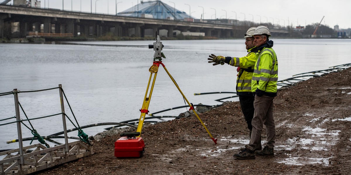
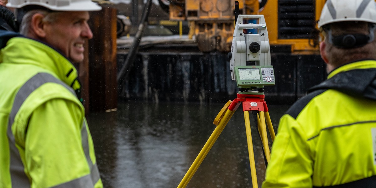
The monitoring teams use total stations (TPS) to capture data and complete the majority of the fieldwork. With the onboard Leica Captivate app, the deformation of every prism can be checked in real-time, as deviations from the base positions are shown on the screen after each measurement and validated against defined thresholds.
ROCO’s lead surveyor for monitoring on the Oosterweel Link, Panagiotis Oikonomidis explains, “As a surveyor it is easy to input the wrong point name or prism constant or to misidentify a prism or to miss one when measuring large numbers of targets. We cannot afford the time or manpower to go back for remeasurements, or to misreport that nothing was happening and miss potential deformation. After measuring all the points to establish base readings, and uploading to the TPS, the onboard Captivate monitoring app automatically remeasures them all with the correct settings.”
“The ability for the robotic TPS, once setup, to measure all the known points correctly, every time, is a huge quality assurance win. We know that when we get a record for a point that it’s the correct point and the data is valid. This saves us time and validates our work.”
ROCO’s surveyors started using the Captivate app on the same day it was introduced, having only needed a little training. They found Captivate’s on-screen instructions and workflow styles easy to follow and intuitive. The app displays real-time calculations and allows users to view displacement from base readings after each measurement. Since all measurements are automatically checked and validated, ROCO knows that in-field quality assurance is based on accurate data, correct at the point of measurement every time.

Customer Feedback Drives New Release
The Leica Geosystems team stayed in regular contact with the customer and often visited site to ensure the monitoring team had all the support they needed from their manufacturing partner as the project progressed. This relationship gained valuable customer feedback, driving a new development to increase data capacity on the Captivate TPS Monitoring app.
ROCO's head of survey, Bert Limbos states, “Our relationship with Leica Geosystems is very valuable to us, so when we needed to expand the app's use to handle the increased flow of data, we discussed this with the support team, who was very receptive to our feedback. Based on our use, they worked with us to further develop and upgrade the app's functionality, further improving our workflow and efficiency.”
Consulting with Leica Geosystems has been instrumental in helping ROCO optimise data capture efficiency. With a modern, smart and flexible semi-automated campaign monitoring solution using Leica total stations and the onboard monitoring app for Leica Captivate, ROCO’s teams save time and improve quality assurance, as decisions are always based on real-time, error-free, accurate data using a trusted solution.


