


Systèmes aéroportés

Solutions
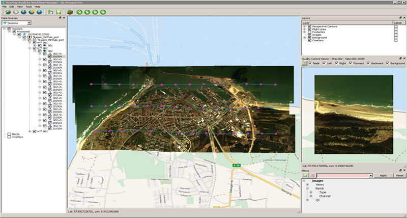
Les solutions combinées de capteurs aéroportés et de chaînes de traitement permettent de répondre aux besoins particuliers de votre application.
Les solutions combinées de capteurs aéroportés et de chaînes de traitement permettent de répondre aux besoins particuliers de votre application.

Leica CityMapper-2
The first hybrid solution integrating oblique imaging and LiDAR into a single system, purpose-built for efficient urban data capture.
The first hybrid solution integrating oblique imaging and LiDAR into a single system, purpose-built for efficient urban data capture.

Imaging Sensors
Sensor technology - setting the standards in airborne data acquisition.
Sensor technology - setting the standards in airborne data acquisition.

Topographic LiDAR Sensors
Linear-mode LiDAR sensor that offers maximum flexibility for complex regional LiDAR mapping projects
Linear-mode LiDAR sensor that offers maximum flexibility for complex regional LiDAR mapping projects

Bathymetric LiDAR Sensors
Leica Geosystems bathymetric LiDAR sensors provide seamless data from the seabed onto land.
Leica Geosystems bathymetric LiDAR sensors provide seamless data from the seabed onto land.
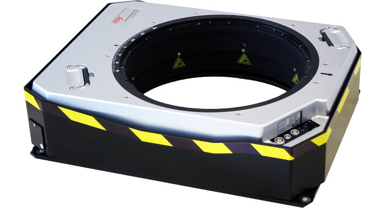
Leica PAV100 Gyro-Stabilised Sensor Mounts
The PAV100 gyro-stabilised sensor mount is a common platform for the previous generation of Leica Geosystems airborne sensors. It provides adaptive control and angular motion compensation.
The PAV100 gyro-stabilised sensor mount is a common platform for the previous generation of Leica Geosystems airborne sensors. It provides adaptive control and angular...