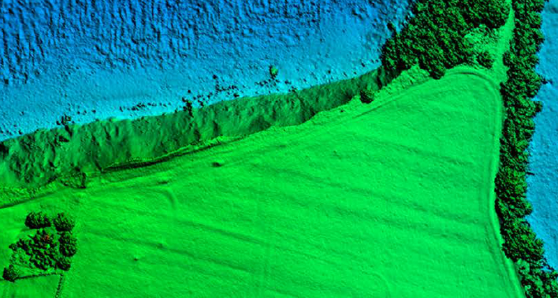
Nearshore charting
The Leica Chiroptera 4X enables charting according to S-44 standards, detects obstruction with oblique LiDAR and collects seamless onshore and shoreline data while offering maximum depth penetration in turbid water conditions.


Efficient coastal survey LiDAR sensor producing seamless data from land to water at 4X the point density

Major productivity gain
With the 4X bathymetric product line, Leica Geosystems introduces an innovative high-resolution technology, increasing the point density by factor 4 compared to previous versions. The Leica Chiroptera 4X offers unrivalled bathymetric point density and depth penetration at the same accuracy, same turbid water performance and with increased sensitivity, offering a productivity gain of >50%.
Most capable coastal surveying system
The Leica Chiroptera 4X is a cost-effective and innovative LiDAR system that simultaneously captures 140.000 points per second in the bathymetric channel (full waveform), and up to 500.000 points per second topographic channel, making it the ultimate tool for seamless coastal and land surveying.
The system is designed to address the growing need of collecting high accuracy data for environmental monitoring and surveying of shallow water regions with survey depth down to 25 m. The shoreline is captured seamlessly and the system includes the Leica RCD30 medium format 80 megapixel camera to generate RGB point clouds.
Highly accurate results in less time
Leica Geosystems airborne bathymetric LiDAR sensors provide seamless data from water to land and seafloor coverage down to 50 m water depth.
Leica Geosystems airborne bathymetric LiDAR sensors provide seamless data from water to land and seafloor coverage down to 50 m water depth.