


Leica Zeno Connect
High accuracy tilt-compensated GNSS (GPS) positions for your application
.png?h=740&iar=0&w=2480&rev=fd4e6c61b0e64a4eb00e637a7ff55e22&hash=276DDC721EAD0E11165A4C00A039DA8E)
Does your app require high accuracy GNSS (GPS) data? Do you need the flexibility to measure with a tilted pole?
Leica Zeno Connect is a mobile application designed to streamline the integration of GNSS (GPS) smart antennas into third-party applications. The app establishes a connection between your mobile device and the Leica Zeno smart antenna, taking care of critical tasks like applying coordinate systems and configuring RTK or PPP correction services for precise positioning.
Once configured, Zeno Connect enables efficient and reliable integration with your preferred mobile or web app and ensures precise positioning data is embedded in your workflows.
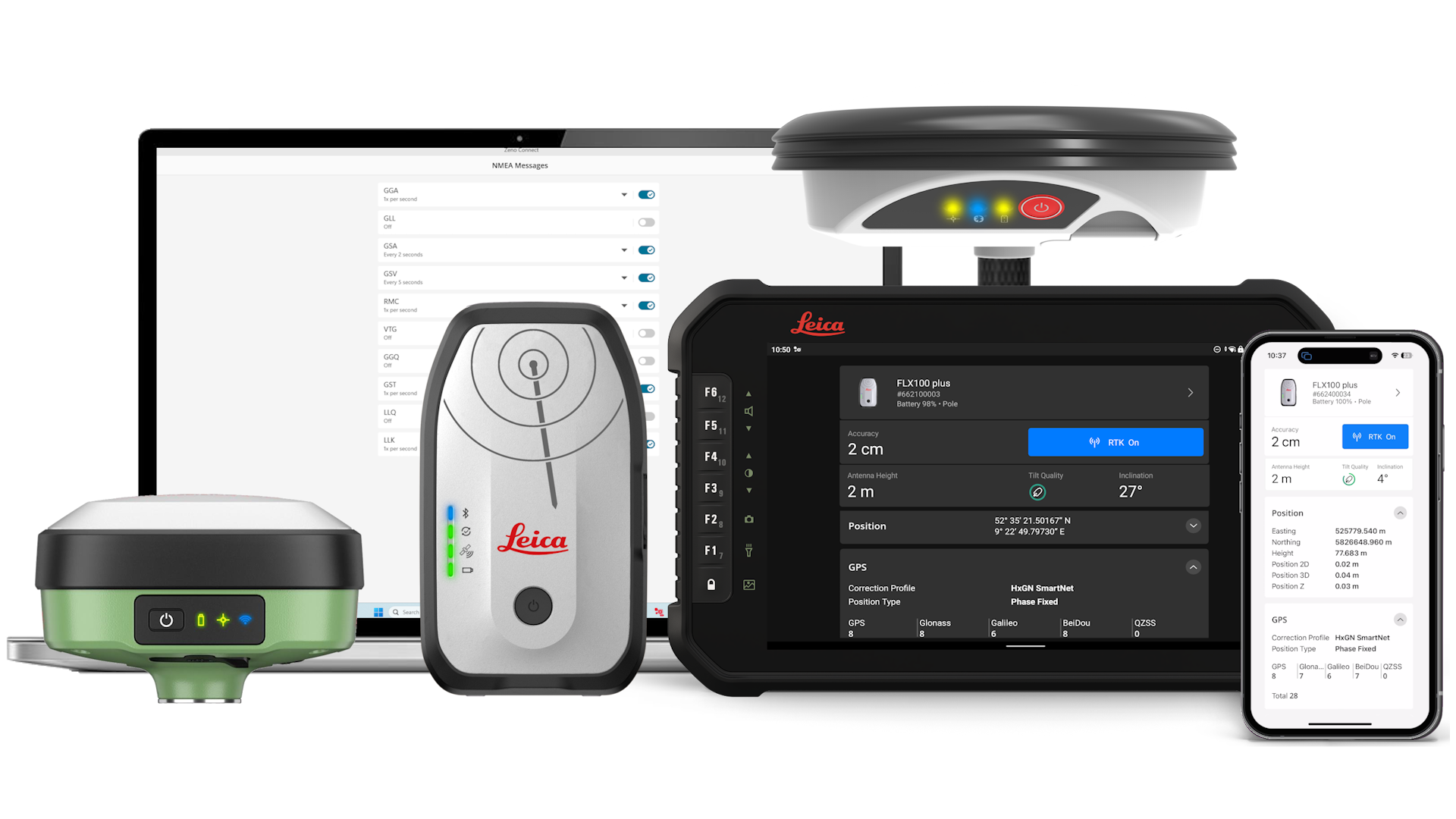
Leica Zeno Connect simplifies integration of GNSS (GPS) and tilt-compensated positions into third-party apps, thanks to the Leica Zeno WebSocket API.
Are you a software developer?
Learn more about the Zeno WebSocket API
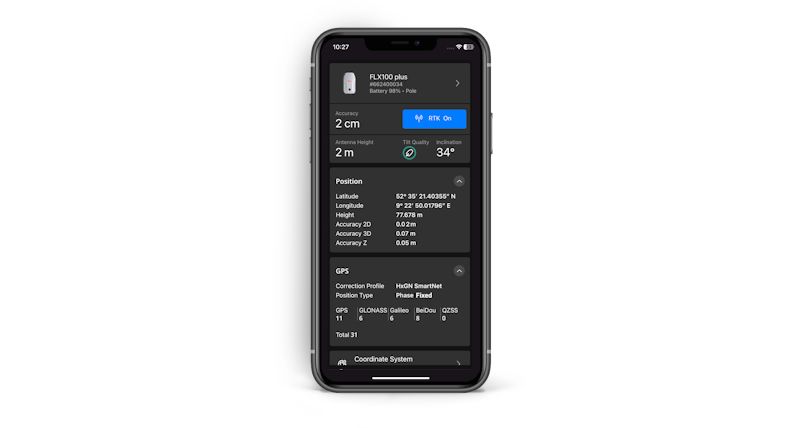
Zeno Connect outputs the pole-tip position, enabling third-party apps to easily integrate tilt-compensated smart antennas for asset collection workflows.

Supported antennas.
Leica Zeno FLX100 plus, Leica Zeno GG04 plus, Leica GS05, Leica iCG30.
Native and web app support.
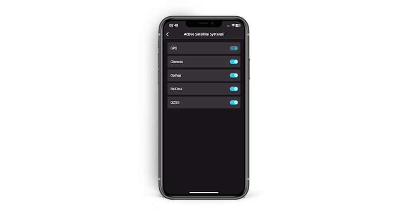
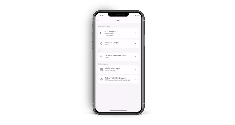
Thanks to the Leica Zeno WebSocket API, position, tilt and other metadata are accessible for both native and web apps. The app is available on devices running iOS, Android, and Windows operating systems.
Smart design.
Designed for the future—changes for third-party apps are not required no matter how GNSS (GPS) hardware or technology evolves. All messages are delivered in a standardised format for easy parsing and seamless integration.
Tilt integration.
With Zeno Connect and a tilt-compensating smart antenna such as the FLX100 plus, third-party applications can obtain the position of the tilt-compensated pole tip.

Leica Zeno WebSocket Webinar
Watch the webinar on Leica Zeno Connect focusing on its WebSocket capabilities.
Watch the webinar on Leica Zeno Connect focusing on its WebSocket capabilities.

Leica Zeno FLX100 plus
Accuracy on the move with tilt compensating technology.
Accuracy on the move with tilt compensating technology.

Leica Zeno WebSocket API
Easily integrate GNSS data in your own app with Leica Zeno Connect.
Easily integrate GNSS data in your own app with Leica Zeno Connect.

HxGN SmartNet
HxGN SmartNet provides trusted GNSS data over more than 5,300 reference stations worldwide.
HxGN SmartNet provides trusted GNSS data over more than 5,300 reference stations worldwide.