


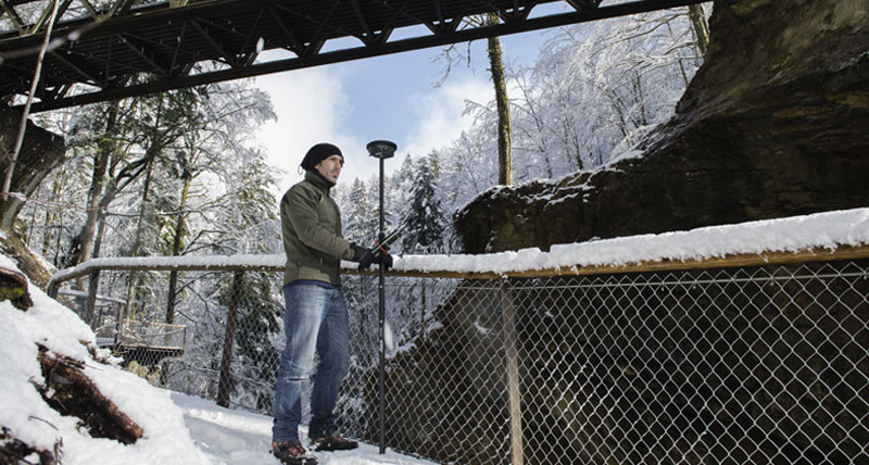
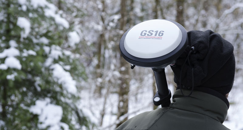
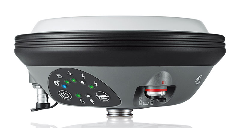
Móvel GNSS Leica Viva GS16
Antena GNSS inteligente leve para um posicionamento preciso

A Leica Viva GS16 é uma antena GNSS inteligente potente com capacidade de aprendizagem automática. O número crescente de sinais provenientes de constelações de satélites cada vez maiores exige que o recetor GNSS seja inteligente e fiável. A GS16 é uma ferramenta de medição robusta para os topógrafos que precisam de um sistema GNSS que seja leve para transportar para qualquer lado, mas que suporte bem as condições mais exigentes. A GS16 é uma solução inteligente - Utilize-o como um móvel ou como uma referência de confiança.

ENGAGING SOFTWARE
The Leica Captivate field software is the perfect companion for the GS16. With easy-to-use apps, all measured and design data can be viewed and used, providing you with a clear understanding of your data in 2D and 3D view. Captivate spans industries and applications with little more than a simple tap, regardless of whether you work with GNSS, total stations or both.
EXCELLENT MEASUREMENT QUALITY
Tracking multi-frequency signals comes as standard with all Leica Geosystems GS sensors. Combined with an excellent GNSS antenna element and a position update rate of 20 Hz, GS16 ensures reliable measurement quality.
IMPROVED PERFORMANCE
Multipath reduction option in Captivate boosts GNSS signal tracking quality under harsh environments, which improves RTK availability and accuracy. Also, an interference toolkit mitigates out-of-band interferences, which allows users to obtain the highest robustness of signal tracking.
ACTIVE CUSTOMER CARE
Through Active Customer Care (ACC), a global network of experienced professionals is only a click away to guide you through any challenge. Control your costs with a Customer Care Package (CCP) which gives you peace of mind you are covered anywhere, anytime.
Brochure
Leica Viva GS16 smart antenna brochure
Data sheet
Leica Viva GS16 data sheet
Compare GNSS solutions
GNSS comparison chart

Contact us about GNSS systems
Get in contact with us about Leica Geosystems GNSS sensors.
Get in contact with us about Leica Geosystems GNSS sensors.

Tabela Comparativa GNSS
As of v7.0.1, Safari exhibits a bug in which resizing your browser horizontally causes rendering errors in the justified nav that are cleared upon refreshing.
As of v7.0.1, Safari exhibits a bug in which resizing your browser horizontally causes rendering errors in the justified nav that are cleared upon refreshing.
Leica Infinity
Leica Infinity is the user-friendly geospatial office software for the measurement professionals. The surveying software is designed to manage, process, analyse and quality check all field survey measure data, including total stations, digital levels, GNSS and UAVs.
Leica Infinity is the user-friendly geospatial office software for the measurement professionals. The surveying software is designed to manage, process, analyse and quality...

HxGN SmartNet Global
HxGN SmartNet Global provides seamless positioning and streamlines your solution with Leica Geosystems GS smart antennas.
We have you covered. Everywhere.
We have you covered. Everywhere.
HxGN SmartNet Global provides seamless positioning and streamlines your solution with Leica Geosystems GS smart antennas.
We have you covered. Everywhere.
We have you covered. Everywhere.


$name
As of v7.0.1, Safari exhibits a bug in which resizing your browser horizontally causes rendering errors in the justified nav that are cleared upon refreshing.
As of v7.0.1, Safari exhibits a bug in which resizing your browser horizontally causes rendering errors in the justified nav that are cleared upon refreshing.

Get to know our Public Safety applications and solutions
Create a Forensic Digital Twin with us!
Create a Forensic Digital Twin with us!