


Slide One
Improved safety, faster turnarounds, and easier access to accurate 3D facility documentation.


Wir bieten eine große Auswahl an On-demand-Ressourcen. Registrieren Sie sich für kommende Webinare in unserem Webinar-Hub für Laserscanning.
INTERGEO is the world’s leading conference trade fair for geodesy, geo information and land management.
Hexagon, represented by its divisions Geosystems, PPM & Geospatial and its brands IDS GeoRadar, Leica Geosystems, Listech, Microsurvey, Multivista, Bricsys, SMART Build, Luciad and many more will present at INTERGEO 17 – 19 September in Stuttgart, Germany.
Visit Hall 1, Booth B1.022 to experience Hexagon’s solutions for the geospatial and construction industries.
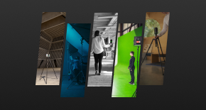
At Hall 1, Booth B1.022, discover the latest technology for mobile mapping; asset collection and management; 3D laser scanning; photogrammetry; remote sensing; airborne sensors and UAVs; GNSS; construction project controls and progress documentation; utility detection; measurement software; cloud-based dynamic map; and many more solutions for the geospatial and construction industries. The latest innovations will be on display for hands-on demos and experts will be ready to answer any questions. Solutions featured at the booth include:
INTERGEO is the world’s leading conference trade fair for geodesy, geo information and land management.
Hexagon, represented by its divisions Geosystems, PPM & Geospatial and its brands IDS GeoRadar, Leica Geosystems, Listech, Microsurvey, Multivista, Bricsys, SMART Build, Luciad and many more will present at INTERGEO 17 – 19 September in Stuttgart, Germany.
Visit Hall 1, Booth B1.022 to experience Hexagon’s solutions for the geospatial and construction industries.
At Hall 1, Booth B1.022, discover the latest technology for mobile mapping; asset collection and management; 3D laser scanning; photogrammetry; remote sensing; airborne sensors and UAVs; GNSS; construction project controls and progress documentation; utility detection; measurement software; cloud-based dynamic map; and many more solutions for the geospatial and construction industries. The latest innovations will be on display for hands-on demos and experts will be ready to answer any questions. Solutions featured at the booth include:


