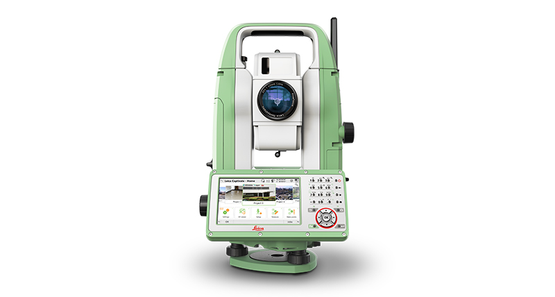
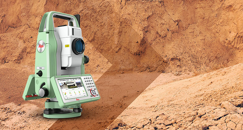
Leica FlexLine TS10 Manual Total Station
Top performance and precision for high-demanding measurement and layout tasks

Leica FlexLine TS10 is a high-end manual total station, enabling you to carry out high-demand survey tasks with Leica Captivate software. This way you can participate in the world of 3D by benefiting from 3D views of your measured data.
The TS10 solves daily professional challenges and tasks for growing demands within surveying and mapping, building construction and civil engineering:
- Managing directors of construction departments benefit from minimal downtime of your survey crews to deliver projects under budget and in time.
- Survey managers can rely on the highest product durability in the market, which increases your planning certainty.
- Surveyors work faster by measuring more points per day with less measurement errors and rework.
Leica FlexLine: The new generation of manual total stations
The new Leica FlexLine series is based on a proven product concept, revolutionising the world of measurement and survey for nearly 200 years. Unlike any other manual total stations in the market, Leica Geosystems manual total stations focus on providing the highest quality, the lowest total cost of ownership and the longest durability in the industry, enabling users to work with purpose-driven solutions for the best performance results.
AutoHeight: Revolutionising instrument height measurement
The TS10 offers the world’s first AutoHeight feature as an option. AutoHeight enables the instrument to automatically measure, read and set its instrument height. Prevent time consuming manual effort and eliminate critical errors during the instrument setup when this revolutionary feature uses a laser from the instrument to measure to the ground and automatically passes the measurement to the software.
Leica Captivate software: Comprehensive, intuitive and easy to use
The TS10 is equipped with the Leica Captivate field software, a comprehensive application-based software package. This intuitive, familiar software helps you to capture even more points than before. You are also able to tie into the modern 3D dataflow and rigorous quality assurance and control routines.
Service and support: Global, local and best-in-class
Now with optional mobile internet access the TS10 connects to the office for a seamless dataflow and to Leica Geosystems trusted global service and support at the touch of a button. With the Active Customer Care program and myWorld customer portal, users have access to latest software updates, service and support as well as to mySecurity. With mySecurity activated, the locking mechanism ensures the device is disabled and can no longer be used.
Lorem Ipsum 1
Lorem ipsum dolor sit amet, consectetur adipiscing elit, sed do eiusmod tempor incididunt ut labore et dolore magna aliqua. Ut enim ad minim veniam, quis nostrud exercitation ullamco laboris nisi ut aliquip ex ea commodo consequat. Duis aute irure dolor in reprehenderit in voluptate velit esse cillum dolore eu fugiat nulla pariatur. Excepteur sint occaecat cupidatat non proident, sunt in culpa qui officia deserunt mollit anim id est laborum.
Lorem Ipsum 2
Lorem ipsum dolor sit amet, consectetur adipiscing elit, sed do eiusmod tempor incididunt ut labore et dolore magna aliqua. Ut enim ad minim veniam, quis nostrud exercitation ullamco laboris nisi ut aliquip ex ea commodo consequat. Duis aute irure dolor in reprehenderit in voluptate velit esse cillum dolore eu fugiat nulla pariatur. Excepteur sint occaecat cupidatat non proident, sunt in culpa qui officia deserunt mollit anim id est laborum.
Lorem Ipsum 3
Lorem ipsum dolor sit amet, consectetur adipiscing elit, sed do eiusmod tempor incididunt ut labore et dolore magna aliqua. Ut enim ad minim veniam, quis nostrud exercitation ullamco laboris nisi ut aliquip ex ea commodo consequat. Duis aute irure dolor in reprehenderit in voluptate velit esse cillum dolore eu fugiat nulla pariatur. Excepteur sint occaecat cupidatat non proident, sunt in culpa qui officia deserunt mollit anim id est laborum.
Lorem Ipsum 4
Lorem ipsum dolor sit amet, consectetur adipiscing elit, sed do eiusmod tempor incididunt ut labore et dolore magna aliqua. Ut enim ad minim veniam, quis nostrud exercitation ullamco laboris nisi ut aliquip ex ea commodo consequat. Duis aute irure dolor in reprehenderit in voluptate velit esse cillum dolore eu fugiat nulla pariatur. Excepteur sint occaecat cupidatat non proident, sunt in culpa qui officia deserunt mollit anim id est laborum.
PROFIT FROM MOBILE CONNECTIVITY
With optional mobile internet access, you can share your data online much faster, receive design data from your designers and engineers onsite, and use Leica Geosystems services – such as Leica Exchange or Leica Active Assist.
SAVE TIME WITH AUTOHEIGHT
This revolutionary feature enables your TS10 to automatically measure, read and set its own height. This capability minimises errors and accelerates the setup process onsite.
Data sheets
Leica FlexLine Series data sheet
Leica FlexLine TS10 data sheet
White Papers
The AutoHeight feature
Lowest total cost of ownership (TCO)
Poster
Leica FlexLine TS10 overview poster
Technical Documents
Total Station Specifications in Daily Surveying
eBooks & Guides
Leica FlexLine Advantage eBook


