


Expert Insights

A PURE SURVEYING EQUIPMENT PORTFOLIO
Hear how our pure surveying equipment portfolio can help you face any measurement challenge; from mapping entire cities, through measuring a single street, to working on an individual building - Leica Geosystems is here to help.
Hear how our pure surveying equipment portfolio can help you face any measurement challenge; from mapping entire cities, through measuring a single street, to working on an individual building - Leica Geosystems is here to help.

LEICA GS18 I - MEASURE WHAT YOU SEE
Leica GS18 I with Visual Positioning Technology overcomes conventional GNSS reception and satellite signal needs by measuring points remotely using images,See how you can measure hard-to-reach points safely and with survey-grade accuracy.
Leica GS18 I with Visual Positioning Technology overcomes conventional GNSS reception and satellite signal needs by measuring points remotely using images,See how you can measure hard-to-reach points safely and with survey-grade accuracy.

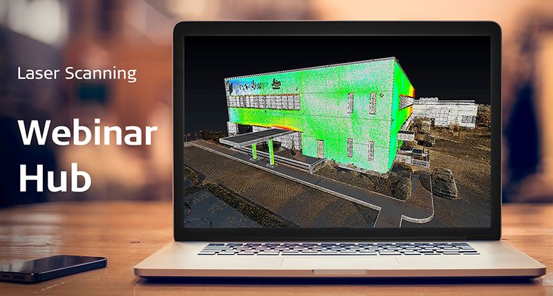
LASER SCANNING TECHNOLOGY BREAKTHROUGHS
Discover the RTC360, Cyclone FIELD 360 mobile field app and Cyclone REGISTER 360 office software, and see how professionals new to laser scanning can efficiently collect and transform data into digital reality models.
Discover the RTC360, Cyclone FIELD 360 mobile field app and Cyclone REGISTER 360 office software, and see how professionals new to laser scanning can efficiently collect and transform data into digital reality models.

TOTAL MONITORING: GEODETIC MONITORING
This webinar is dedicated to our new generation of Monitoring Software and Monitoring Total Stations, covering in particular Leica GeoMoS Edge and Leica Nova TM60. See how the new solution will optimise your workflow.
This webinar is dedicated to our new generation of Monitoring Software and Monitoring Total Stations, covering in particular Leica GeoMoS Edge and Leica Nova TM60. See how the new solution will optimise your workflow.

DO MORE WITH LEICA CAPTIVATE
Think you know Leica Captivate? There are probably many Leica Captivate apps which could make your life easier. In this presentation we share insights into Leica Captivate apps and the possibilities this software will open up for your everyday survey tasks.
Think you know Leica Captivate? There are probably many Leica Captivate apps which could make your life easier. In this presentation we share insights into Leica Captivate apps and the possibilities this software will open up for your everyday survey tasks.

LEICA GS18 I - MAPPING AND UTILITY APPLICATIONS
With the GS18 I, you can measure obstructed or hard-to-reach points safely with survey-grade accuracy remotely using images. Creating a point cloud from the collected data opens new possibilities and adds versatility.
With the GS18 I, you can measure obstructed or hard-to-reach points safely with survey-grade accuracy remotely using images. Creating a point cloud from the collected data opens new possibilities and adds versatility.

REALITY CAPTURE WITH MOBILE MAPPING
From the smallest road sign to the largest highways or railway infrastructures, Leica Geosystems reality capture solutions provide deeper insights and deliver actionable information to help build a smarter and safer world.
From the smallest road sign to the largest highways or railway infrastructures, Leica Geosystems reality capture solutions provide deeper insights and deliver actionable information to help build a smarter and safer world.

MONITORING SOLUTIONS
An introduction of the Hexagon Total Monitoring solution. Find out what’s new in radar monitoring and how these solutions can be applied to fast events collapse detection and tunnel face monitoring during construction activities.
An introduction of the Hexagon Total Monitoring solution. Find out what’s new in radar monitoring and how these solutions can be applied to fast events collapse detection and tunnel face monitoring during construction activities.

THE NEXT GENERATION OF MANUAL TOTAL STATIONS
View key features from the modernised Field Software towards improved dataflow possibilities, see our theft deterrence solution and learn how to measure your instrument height using AutoHeight.
View key features from the modernised Field Software towards improved dataflow possibilities, see our theft deterrence solution and learn how to measure your instrument height using...

LEICA GS18 I - TECHNOLOGY UNDER THE COVERS
How did we ensure the survey-grade accuracy of the GS18 I data? Take a sneak peak at the technology used in the GS18 I to enable Visual Positioning.
How did we ensure the survey-grade accuracy of the GS18 I data? Take a sneak peak at the technology used in the GS18 I to enable Visual...

COMPLETE FIELD-TO-FINISH WORKFLOW
An introduction to Hexagon’s latest reality capture product portfolio and overview on the field-to-finish, capture-to-complete workflows leveraged by reality capture users today to deliver final analysis and results.
An introduction to Hexagon’s latest reality capture product portfolio and overview on the field-to-finish, capture-to-complete workflows leveraged by reality capture users today to deliver final analysis and results.

LEICA INFINITY - GETTING THE MOST FROM GS18 I IMAGES
Hear tips for getting the best survey-grade results with GS18 I. Learn how to further expand on the field capabilities and bring your workflow to the office with Leica Infinity, reviewing and measuring points in the office and generating point clouds from GS18 I.
Hear tips for getting the best survey-grade results with GS18 I. Learn how to further expand on the field capabilities and bring your workflow to the office with Leica Infinity, reviewing and measuring points in the office and generating point clouds from GS18 I.

NEW GS18 I LIVE DEMO
See how to capture and measure obstructed points using the GS18 I in this live demo.
See how to capture and measure obstructed points using the GS18 I in this live demo.

LEICA BLK2GO - A UNIQUE MOBILE, IMAGING LASER SCANNER
In this webinar, our subject matter experts show you the fastest and easiest way to capture your project, specifically in the context of a space management or facilities management project.
In this webinar, our subject matter experts show you the fastest and easiest way to capture your project, specifically in the context of a space management or facilities management project.

LEICA NOVA MS60 - A MULTI-TALENT FOR EVERY APPLICATION
Learn more about the technology that makes a MultiStation, and be inspired by real world examples of where MultiStations are being used all over the globe to understand the scope of what these instruments can deliver.
Learn more about the technology that makes a MultiStation, and be inspired by real world examples of where MultiStations are being used all over the globe to understand the scope of what these instruments can deliver.

P2U - DIGITISATION OF A HISTORIC MOUNTAIN ROAD
For the first time, a historic Alpine road in Germany must be digitised as part of the regular building inspection. Learn more how ing.GEOVISION used the Leica Pegasus:Two Ultimate (P2U) to create a complete digital twin to extract the most important information.
For the first time, a historic Alpine road in Germany must be digitised as part of the regular building inspection. Learn more how ing.GEOVISION used the Leica Pegasus:Two Ultimate (P2U) to create a complete digital twin to extract the most important information.

LEICA TS16 - THE WORLD’S FIRST SELF-LEARNING TOTAL STATION
Learn more about the Leica TS16 - the world’s first self-learning total station. learn about ATRplus, what the term "self-learning" means, how it contributes to the outstanding automation performance of the TS16 and much more.
Learn more about the Leica TS16 - the world’s first self-learning total station. learn about ATRplus, what the term "self-learning" means, how it contributes to the outstanding automation performance of the TS16 and much more.

REALITY CAPTURE FROM GROUND TO AIR - WHEN DATA MATTERS
Capturing reality to create a digital twin is a common part of surveyors' day-to-day work. When you can trust your terrestrial scans in combination with UAV data, you get the real benefits. We showcase how Leica Geosystems UAV data helps get the job done.
Capturing reality to create a digital twin is a common part of surveyors' day-to-day work. When you can trust your terrestrial scans in combination with UAV data, you get the real benefits. We showcase how Leica Geosystems UAV data helps get the job done.

LEICA INFINITY - GETTING THE MOST FROM EVERY IMAGE
Learn how combining image sources contribute to adding context to the job site and significantly reduce time for completing project work.
Learn how combining image sources contribute to adding context to the job site and significantly reduce time for completing project work.

3D LASER SCANNERS: A PERFECT TOOL FOR SURVEYORS
Discover the different benefits of Leica Geosystems 3D Laser Scanner product portfolio that includes tools designed for simplicity, speed, precision, and effectiveness in all environmental conditions with Hexagon’s Andrea Biasion.
Discover the different benefits of Leica Geosystems 3D Laser Scanner product portfolio that includes tools designed for simplicity, speed, precision, and effectiveness in all environmental conditions with Hexagon’s Andrea Biasion.

GROW YOUR BUSINESS WITH DEFORMATION MONITORING
How does a surveying service provider add monitoring to their services – our very own business development manager shares his insights and experience.
How does a surveying service provider add monitoring to their services – our very own business development manager shares his insights and experience.

MAXIMIZE THE UNDERGROUND UTILITY MAPPING PROCESS
Learn more on Stream UP and IQMaps latest developments and be inspired by a massive underground utility project easily managed with IQMaps.
Learn more on Stream UP and IQMaps latest developments and be inspired by a massive underground utility project easily managed with IQMaps.