


As-Built Survey


Leica SiRoadScan
Leica SiRoadScan is a complete software package providing extraction and analysis of 3-D laser scan data for the highway and roads industry.
Leica SiRoadScan is a complete software package providing extraction and analysis of 3-D laser scan data for the highway and roads industry.

Leica Viva TS16
Self-learning, survey-grade total station for all conditions.
Self-learning, survey-grade total station for all conditions.

Leica Captivate
Perangkat lunak 3D yang digunakan di lapangan melengkapi pengambilan dan pengelolaan data.
Perangkat lunak 3D yang digunakan di lapangan melengkapi pengambilan dan pengelolaan data.

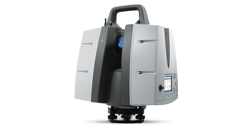
Leica Nova MS60
One instrument for all your surveying tasks, bringing sensor fusion to the next level.
One instrument for all your surveying tasks, bringing sensor fusion to the next level.

Leica GS18 T
Introducing the world’s fastest GNSS RTK rover with true tilt compensation - immune to magnetic disturbances and calibration-free.
Introducing the world’s fastest GNSS RTK rover with true tilt compensation - immune to magnetic disturbances and calibration-free.

Leica ProScan
Mobile platform to increase your laser scanning productivity.
Mobile platform to increase your laser scanning productivity.

Sistem UAV
Solusi pemetaan udara cerdas untuk survei dan konstruksi.
Solusi pemetaan udara cerdas untuk survei dan konstruksi.

Leica Rail:Factory & ATrack
Leica Rail:Factory & ATrack Rail assessment software for Mobile Mapping Sensors
Leica Rail:Factory & ATrack Rail assessment software for Mobile Mapping Sensors
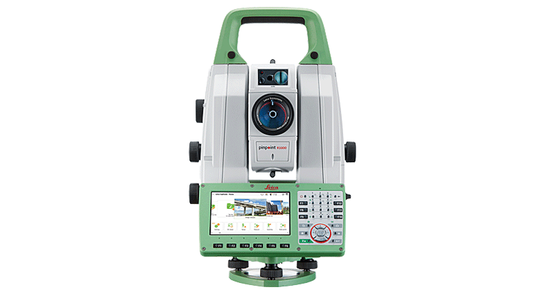
Leica Nova TS60
Most accurate total station for precise tasks under any condition.
Most accurate total station for precise tasks under any condition.