


모바일 매핑 고객사례과 인사이트
최첨단 3D 데이터 캡처 기술로 Digital Reality 구축

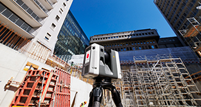
What is mobile mapping?
Discover how mobile mapping technologies enable the regular 3D capture and digitisation of changing environments.

Informed decision making
Find out how to move your surveying work from the field to the office, offering you a foundation for informed decision making.

Digitising environment
Mobile mapping can save 60 per cent of your project costs with digital review process and integrated system. Find out how.


The Road Less Travelled
Ing Geovision used the Leica Pegasus:Two Ultimate to create a complete digital twin of a historic Alpine road in Germany.
Ing Geovision used the Leica Pegasus:Two Ultimate to create a complete digital twin of a historic Alpine road in Germany.

Fast rail asset capture
Mobile mapping enabled the efficient 3D capture of the Gotthard Base Tunnel
Mobile mapping enabled the efficient 3D capture of the Gotthard Base Tunnel

What is mobile mapping?
The technologies enabling 3D mobile mapping and better understanding
The technologies enabling 3D mobile mapping and better understanding
Surveying without traffic disruption
Topographic survey of 119 sites in 12 days without disrupting traffic
Topographic survey of 119 sites in 12 days without disrupting traffic

Digitising environments
Four technologies that enable a digitised future for more informed decision making
Four technologies that enable a digitised future for more informed decision making

Public safety transformation
Evacuation route planning in Berlin’s metro stations and adjacent streets
Evacuation route planning in Berlin’s metro stations and adjacent streets

City digitalisation made easy
Mobile mapping enabled to digitalise two French cities in 3D in only five weeks
Mobile mapping enabled to digitalise two French cities in 3D in only five weeks

Kinematic tunnel scanning
Kinematic high definition scanning enabled 3D mapping of 13.5 km tunnel in four nights
Kinematic high definition scanning enabled 3D mapping of 13.5 km tunnel in four nights


Contact our Public Safety, Security and Forensics experts
Peer-to-peer advice from experienced Public Safety experts
Peer-to-peer advice from experienced Public Safety experts