


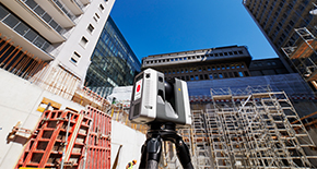

Leica TerrainMapper-3-LiDAR-sensor met lineaire modus
De allesomvattende sensor voor veelzijdige LiDAR-kartering vanuit de lucht

De Leica TerrainMapper-3 is de nieuwste LiDAR airborne sensor met lineaire modus en biedt meer flexibiliteit dan ooit tevoren. Nieuwe functies en verbeterde oude capaciteiten breiden het werkingsbereik van ons LiDAR-luchtaanbod uit, waardoor gebruikers heel wat verschillende taken kunnen uitvoeren waarvoor vroeger meerdere systemen nodig waren. Pak toepassingen van LiDAR-gegevensverzameling over grote gebieden tot tracékarteringsprojecten met de hoogste dichtheid aan, allemaal met hetzelfde systeem. Het gezichtsveld van 60 graden van de TerrainMapper-3 is aanpasbaar en het systeem beschikt over nieuwe, configureerbare scantechnologie en FOV-beeldvorming in vier banden voor simultane matching. Verder is de TerrainMapper-3 ontworpen om de productiviteit van de meest diverse toepassingen aan te scherpen binnen een enkel systeem. De sensor laat zich naadloos integreren in de allesomvattende verwerkingsworkflow van Leica HxMap en ondersteunt klanten van missieplanning tot productgeneratie om de hoogste waarde uit de gegevens te halen.


Flexibele scanpatronen
Het cirkelvormige scanpatroon verbetert het modelleren in 3D van stedelijke gebieden met een lagere densiteit of steile terreinen. Het ellipsvormige scanpatroon, daarentegen optimaliseert gegevensverzameling in dichtbebouwde stedelijke gebieden. Het scanpatroon met gekantelde ellips zorgt voor een betere puntdichtheid voor toepassingen met infrastructuur en tracékartering.
Het cirkelvormige scanpatroon verbetert het modelleren in 3D van stedelijke gebieden met een lagere densiteit of steile terreinen. Het ellipsvormige scanpatroon, daarentegen optimaliseert gegevensverzameling in dichtbebouwde stedelijke gebieden. Het scanpatroon met gekantelde ellips zorgt voor een betere puntdichtheid voor toepassingen met...


Zeer nauwkeurige gegevens
De verminderde straalafwijking zorgt voor nauwkeurigere planimetrie, en de nieuwe MPIA-verwerking zorgt voor meer consistentie in de gegevens, zelfs bij steil terrein. TerrainMapper-3 introduceert capaciteiten voor volledige wave-form opnames in realtime, zelfs bij de maximale pulssnelheid en voor attribuutuitvoer van de terugkerende puls. Dit opent nieuwe mogelijkheden voor geavanceerde en geautomatiseerde puntclassificatie.
De verminderde straalafwijking zorgt voor nauwkeurigere planimetrie, en de nieuwe MPIA-verwerking zorgt voor meer consistentie in de gegevens, zelfs bij steil terrein. TerrainMapper-3 introduceert capaciteiten voor volledige wave-form opnames in realtime, zelfs bij de maximale pulssnelheid en voor attribuutuitvoer van de terugkerende puls. Dit opent...


Verbeterde efficiëntie
Het nieuwe systeem biedt een efficiënte alles-in-één-oplossing voor professionals op het gebied van airborne gegevensverzameling.-Dankzij de hogere scansnelheden kunnen gebruikers sneller vliegen en toch gegevens van hoge kwaliteit verzamelen. Dankzij de krachtige LiDAR van 2 MHz met een uitgebreid, 60 graden verstelbaar gezichtsveld kunnen gebruikers meer gegevens vastleggen met minder vluchtlijnen.
Het nieuwe systeem biedt een efficiënte alles-in-één-oplossing voor professionals op het gebied van airborne gegevensverzameling.-Dankzij de hogere scansnelheden kunnen gebruikers sneller vliegen en toch gegevens van hoge kwaliteit verzamelen. Dankzij de krachtige LiDAR van 2 MHz met een uitgebreid, 60 graden verstelbaar gezichtsveld kunnen...
In het persbericht vindt u meer informatie over de LiDAR airborne sensor Leica TerrainMapper-3.
Leica TerrainMapper-3
Eén systeem, meerdere LiDAR-toepassingen
Nieuws en case studies


