Leica RTC360 3D-laserskanner
Automatisk registrering av punktskydata i felten for raskere kvalitetskontroll, økt produktivitet og bedre avgjørelser på anlegget.

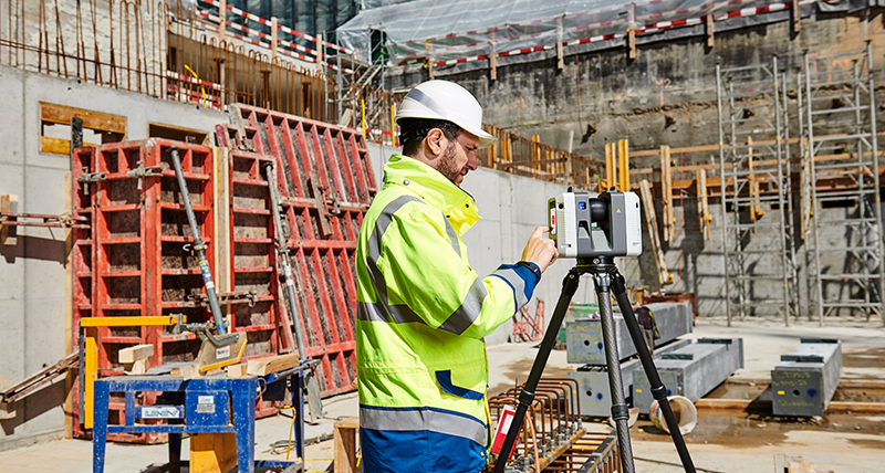
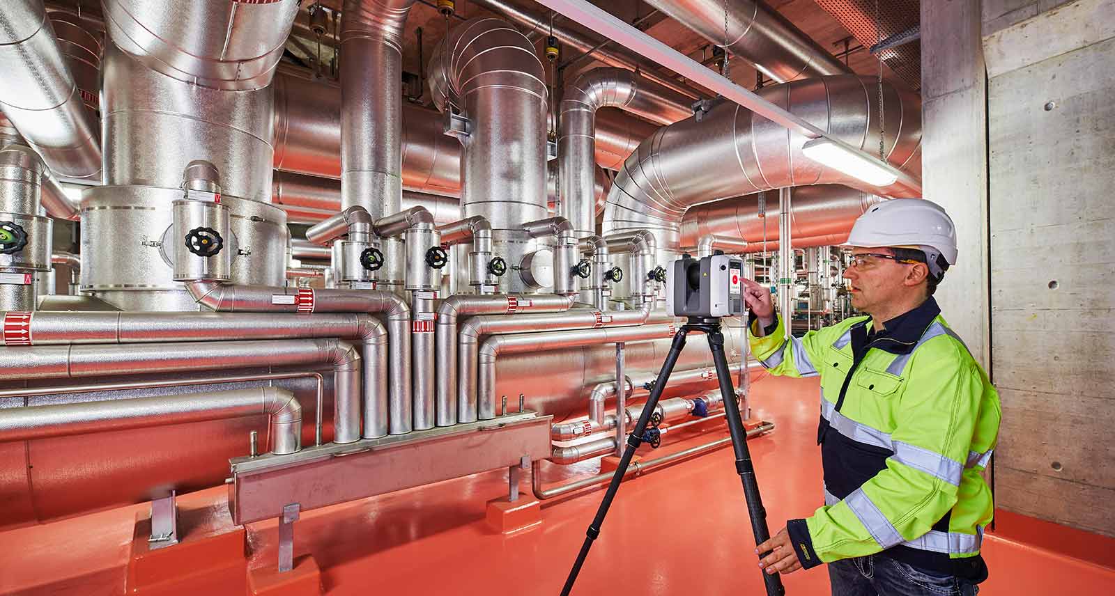
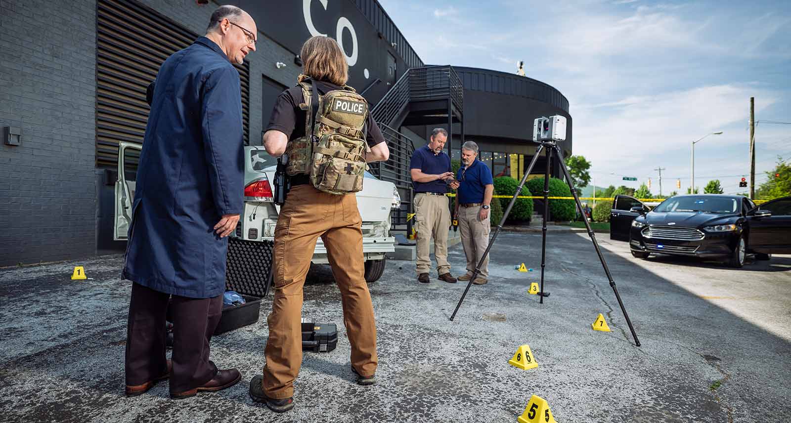
Leica RTC360 3D reality capture-løsning gjør det mulig for brukerne å dokumentere og registrere miljøer i 3D, forbedre effektiviteten og produktiviteten i felten og på kontoret gjennom rask, brukervennlig, nøyaktig og bærbar maskinvare og programvare. RTC360 3D-laserskanneren er en profesjonell løsning for håndtering av komplekse prosjekter med nøyaktig og pålitelig 3D-gjengivelse og kartlegging av mulighetene på alle anlegg.
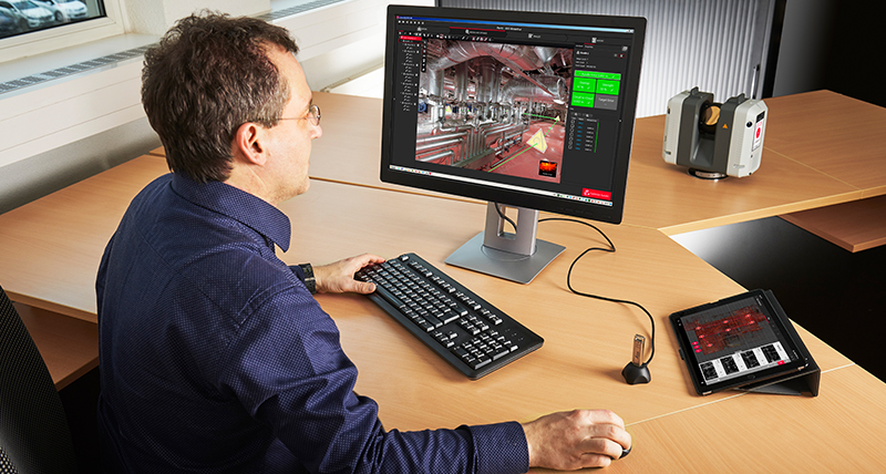
- RTC360-løsningen er en flyttbar løsning med høy automatiseringsgrad, som er designet for maksimal produktivitet. Løsningen kombinerer RTC360 med en avansert 3D-laserskanner og mobilappen, Leica Cyclone FIELD 360 for automatisk registrering av skanninger i sanntid, samt kontorprogramvaren Leica Cyclone REGISTER 360 PLUS slik at du kan integrere 3D-modellen sømløst i arbeidsprosessen.
- Foreta skanninger med svært detaljerte HDR-bilder (High-Dynamic Range) på under to minutter.
- Automatisk registrering av bevegelsene dine fra stasjon til stasjon for forhåndsregistrering av skanninger i felten uten manuelle inngrep.
- Utvid datainnhentingen med informasjonstagger som viser muligheter for bedre planlegging, gjenspeiler de virkelige forholdene på anlegget og styrker teamets kunnskaper om forholdene.
- Registrerte data kan publiseres direkte fra Cyclone FIELD 360 til Reality Cloud Studio, powered by HxDR.
Leica RTC360 med Boston Dynamics Spot
Tilbehørssett og beskyttende ramme nå tilgjengelig! Vil du vite mer??
Rask
Den nye laserskanneren Leica RTC360 gir raskere 3D reality capture enn noensinne. Med en målehastighet på opptil 2 millioner punkter per sekund og avansert HDR-bildesystem kan 3D-punktskyer i farger utarbeides på under to minutter. Automatisert målfri feltregistrering (basert på VIS-teknologi) og sømløs, automatisert overføring av data fra anlegget til kontoret reduserer dessuten tidsbruken i felten og bidrar til enda bedre produktivitet.
Smidig
Leica RTC360-skanneren er liten og lett, og har en portabel utforming med sammenleggbar trefot som er kompakt nok til å få plass i de fleste ryggsekker, slik at utstyret kan tas med overalt. Brukervennlig énknappsbetjening gir rask og problemfri skanning på anlegget.
Nøyaktig
Data med lavt støynivå gir bedre bilder og skarpe skanneresultater med høy kvalitet og høyt detaljnivå, som er klare for bruk i en rekke applikasjoner. Leica RTC360 skanner i kombinasjon med Cyclone FIELD 360 programvare for automatisk registrering i felten gir enestående presisjon som kan kontrolleres på stedet.
Forhåndsregistrering i felten
Cyclone FIELD 360-appen er en del av RTC360-løsningen, og gjør det mulig å koble 3D-datainnhentingen i felten til laserskanneren og dataregistreringen på kontoret med Cyclone REGISTER 360 PLUS. Brukeren på anlegget kan hente inn, registrere og undersøke skanne- og bildedata automatisk. Brukergrensesnittet kombinerer enkel håndtering av komplekse beregninger med grafisk brukerveiledning, og gjør brukeropplevelsen til en fornøyelse også for uerfarne brukere.
Educational Articles & Insights
What is 3D Reality Capture
Changing the Face of Documentation in the Built Environment
Enhancing Public Safety Through 3D Reality Capture
Improving Industrial Health & Safety with 3D Reality Capture
Improving Documentation and Quality Control in a BIM Environment
Digitising Crime Scenes for Better Visibility and Analysis
5 Reasons Digitally Documenting Crash Scenes Improves Outcomes for Investigators
3D Reality Capture for Piping Design: New opportunities, enhanced understanding
White Papers
Leica RTC360 - SLAM in Terrestrial Laser Scanning
Leica RTC360 - Image Resolution white paper
Leica RTC360 - A new approach to Terrestrial Laser Scanning white paper
Sample Data
Building Construction Site 1
Building Construction Site 2
Public Safety Site
Plant Site 1
Plant Site 2 - Setups 001-009 and Setups 010-015
FAST. AGILE. PRECISE. 3D Reality Capture
Leica RTC360 3D Reality Capture Solution - Plant
Leica RTC360 3D Reality Capture Solution in Budapest
Leica RTC360 Demonstration at HxGN LIVE 2018
Tech Highlight Demo: Leica RTC360
Changing the Game for Public Safety Professionals
Boosting ROI with VIS Technology
Eliminating Registration with VIS Technology
The Power of VIS Technology
Behind the Scenes
Talking RTC360 with Juergen Mayer
VR training for Public Safety
Capturing tags on-site on multiple devices
WIRED Magazine explains bullet trajectory analysis with the RTC360
Put your Plant at your fingertips with laser scanning
PortCoast - Fighting time and tide to capture a 5-hectare coastal construction site in 3D
Portcoast - Delivering precise documentation of Port Phu My with 3D laser scanning
How does laser scanning technology transform the construction industry?
JTRS - Providing high quality & timely services to customers with maximum simplicity
Leica RTC360 - The first setup and moving the scanner using VIS
Leica RTC360 - The second setup and linking scans
Leica RTC360 - The third setup and tagging of information
Leica RTC360 - The fourth setup without using VIS
Leica RTC360 - Setting up the scanner on a tripod
Leica RTC360 - Importing data into Cyclone REGISTER 360
Surveying & Engineering
How Hollis Captures Processes Manages And Delivers Reality Capture Data
Surveying Germany's Biggest Aqua Park
The Full Laser Scan Survey of a Grade II Listed Historic Building
Building Construction / AEC
WD Partners Achieves Breakthrough in AEC As-Builts with Fast, Agile and Precise Laser Scanning
Creating the First Digital Shopping Centre In Peru
Plant & Ships
Revolutionising the Luxury Yacht Building Industry with Laser Scanning
Fighting Time and Tide to Capture a 5 Hectare Coastal Construction Site in 3D
Recipe for Success: 3D Laser Scanning for Tank Inspections
Public Safety
Changing the Game for Public Safety Professionals with the World's Fastest Laser Scanner
Laser Scanning Should Be Required for Every School Building; New Technology Makes It Possible
Leica RTC360 Laser Scanner Satisfies the SAPD Collision Investigations Unit’s Need for Speed
Castaneda Engineering Advances Accident Reconstruction with Next-Generation Reality Capture
Spokane PD Uses High-Speed Laser Scanning to Make Easy Work of a Daunting Seven-Acre Scene
Transforming Reality into Photorealistic Virtual Reality with Laser Scanning
Heritage
Unveiling the Mystery - An Ancient Water Clock with Laser Scanning
Preserving Romania's Speleological Heritage with Point Cloud and GNSS Data
Expert Insights
Geo-referencing with Leica RTC360's new Target Extraction WorkflowTo safely say: No crime scene evidence left behind!
Freeze it while it's hot
Discovering the power of laser scanning
Welcoming the RTC360 - In your words
From hardware to software - inside Geosystems' reality capture solutions
A New Development in Laser Scanning Technology
Behind the scenes of the fastest laser scanner on the market
Introducing the new Scanner Live Position feature in Cyclone FIELD 360
Embedding the BLK360 into the 3D Reality Capture workflow
Q&A with BLK360 specialist Andy Fontana on the Cyclone FIELD 360 app
Introducing the Leica Cyclone FIELD 360 app for BLK360
What is the difference between the RTC360 and RTC360 LT
Visual Inertial System (VIS) Technology
Share point cloud data from Cyclone FIELD 360 to TruView Cloud
Integrating the Leica BLK3D into the 3D Reality Capture workflow
Introducing Check & Adjust feature for the RTC360
Cyclone FIELD 360 boosts productivity in the field
Fire scene investigation with the Leica RTC360 laser scanner
Extending the 3D Reality Capture Workflow
Leica Cyclone FIELD 360 Quick Plan simplifies modelling workflows
Leica RTC360 enhancements to increase your efficiency
Customer Insights
Laser scanning from heights
How Element6 delivers the future of plant engineering with laser scanning
Revolutionising Smart Factories with reality capture
Surpassing customer needs with 3D laser scanning
Mapping crashes and collisions at record speeds
Using laser scanning technology for retail redevelopment
Putting the Leica RTC360 LT to the test for boat building and marine applications


