

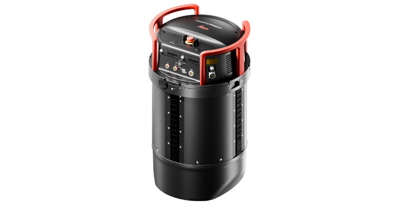
Leica MultiMapper
A portable, easy-to-deploy hybrid airborne system combining imaging and LiDAR to support a wide range of mapping applications.


KONTAKTA OSS:
Växel: 010 - 303 19 00
Service & Montagebokning:
Instrumentservice (geomatik)
010 - 303 19 46
Maskinstyrning
Södra: 010 - 303 19 41
Västra: 010 - 303 19 42
Mellan: 010 - 303 19 43
Östra: 010 - 303 19 44
Norra: 010 - 303 19 45
Support: 010 - 303 19 10
KONTAKTA OSS:
Växel: 010 - 303 19 00
Service & Montagebokning:
Instrumentservice (geomatik)
010 - 303 19 46
Maskinstyrning
Södra: 010 - 303 19 41
Västra: 010 - 303 19 42
Mellan: 010 - 303 19 43
Östra: 010 - 303 19 44
Norra: 010 - 303 19 45
Support: 010 - 303 19 10
KONTAKTA OSS:
Växel: 010 - 303 19 00
Service & Montagebokning:
Instrumentservice (geomatik)
010 - 303 19 46
Maskinstyrning
Södra: 010 - 303 19 41
Västra: 010 - 303 19 42
Mellan: 010 - 303 19 43
Östra: 010 - 303 19 44
Norra: 010 - 303 19 45
Support: 010 - 303 19 10
KONTAKTA OSS:
Växel: 010 - 303 19 00
Service & Montagebokning:
Instrumentservice (geomatik)
010 - 303 19 46
Maskinstyrning
Södra: 010 - 303 19 41
Västra: 010 - 303 19 42
Mellan: 010 - 303 19 43
Östra: 010 - 303 19 44
Norra: 010 - 303 19 45
Support: 010 - 303 19 10
KONTAKTA OSS:
Växel: 010 - 303 19 00
Service & Montagebokning:
Instrumentservice (geomatik)
010 - 303 19 46
Maskinstyrning
Södra: 010 - 303 19 41
Västra: 010 - 303 19 42
Mellan: 010 - 303 19 43
Östra: 010 - 303 19 44
Norra: 010 - 303 19 45
Support: 010 - 303 19 10

A portable, easy-to-deploy hybrid airborne system combining imaging and LiDAR to support a wide range of mapping applications.

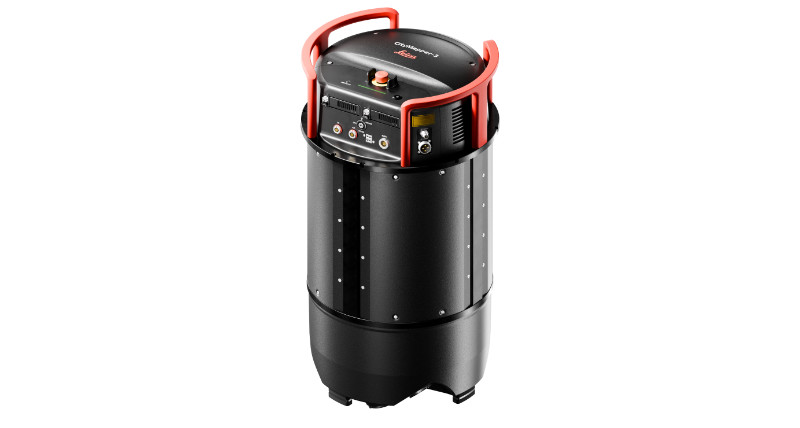
Discover the new Leica CountryMapper hybrid airborne sensor.

A next-generation, configurable hybrid system providing up to 30% efficiency increase for demanding urban and regional mapping applications.
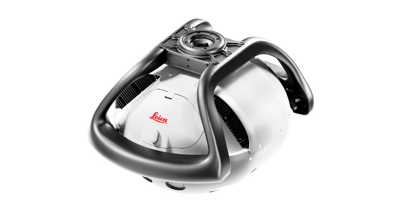
The world's first hybrid sensor for large-area imaging and LiDAR data collection, leveraging Leica Geosystems' leadership in hybrid airborne technologies.

The world’s only hybrid oblique imaging and LiDAR airborne sensor specifically designed for urban mapping applications – now delivering twice the performance
The next-generation configurable hybrid oblique imaging and LiDAR system, delivering unmatched levels of flexibility and performance for efficient urban and regional mapping.
Leica Geosystems’ first compact imaging and LiDAR airborne system, designed for rapid deployment and efficient mapping operations – delivering new levels of flexibility and operational efficiency.

Mjukvarulösningar för luftburna system