


3D-laserscannrar

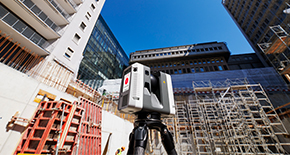
Inom ett område där noggrannhet och effektivitet är avgörande faktorer utgör 3D-laserscannrar från Leica Geosystems grunden för din digitala verklighet. Våra sensorer är utvecklade av experter för att registrera punktmolnsdata och högupplösta bilder och möjliggör detaljerade insikter och analyser.
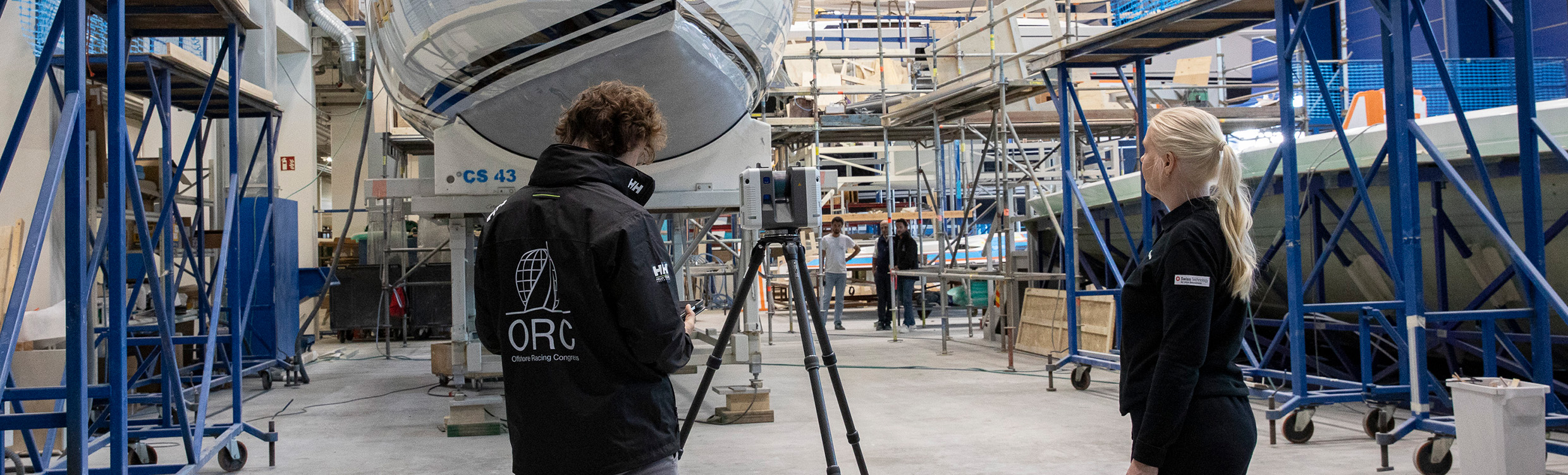
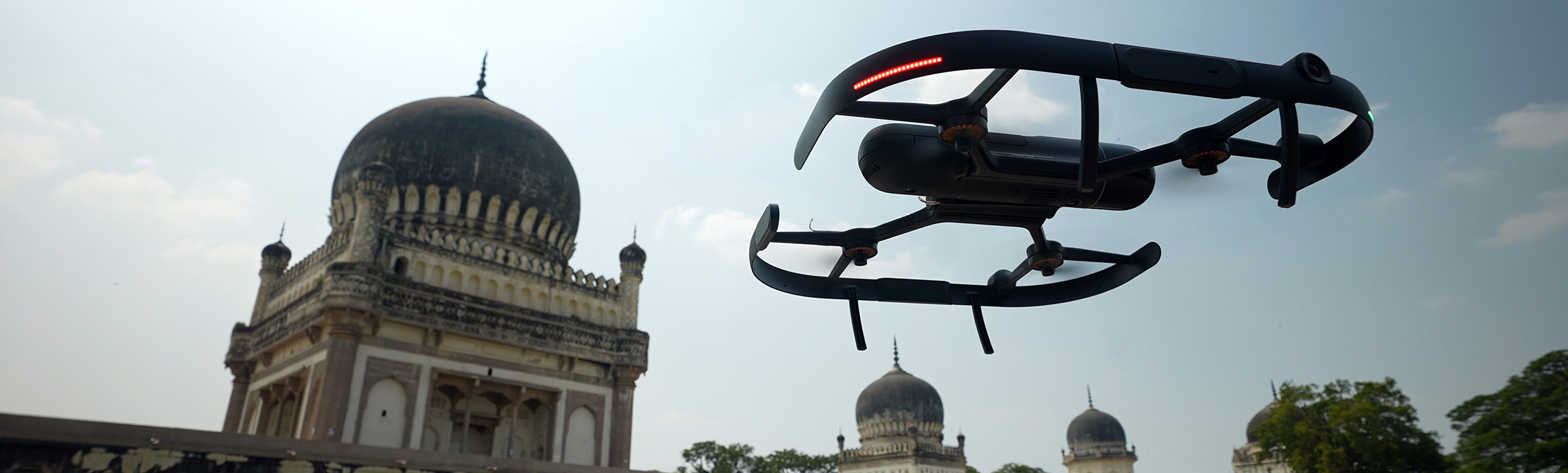
Markbaserade laserscannrar erbjuder hög precision och prestanda och kan kartlägga stora områden och komplexa strukturer mycket exakt på långa avstånd. Våra handhållna enheter är mobila och möjliggör scanning ur ett förstapersonsperspektiv, vilket gör dem flexibla och idealiska för registrering av detaljer i komplexa utrymmen inomhus. För områden utomhus registrerar luftburna laserscannrar omfattande fältdata från otillgängliga vinklar, och vår modul för mobila bärare och robotplattformar förenar scanning och autonomi.
Varje scanning stärker grunden för din digitala verklighet och utökar därmed potentialen med rika datauppsättningar på plats, på kontoret och i molnet.
Markbundna laserscannrar
Högpresterande precisionssensorer registrerar högupplösta bilder och detaljerade punktmolnsdata från komplexa miljöer för att erbjuda oöverträffade insikter och analyser.

Leica BLK360 SE
Leica BLK360 SE är en snabb och användarvänlig 3D-laserscanner — perfekt för mindre projekt där precison, mobilitet och enkelhet sparar tid såväl på plats som på kontoret.
Leica BLK360 SE är en snabb och användarvänlig 3D-laserscanner — perfekt för mindre projekt där precison, mobilitet och enkelhet sparar tid såväl på plats som på kontoret.

Leica BLK360
Leica BLK360 är en innovativ och kompakt bildlaserscanner som registrerar HDR-bilder och punktmolnsdata i 360 grader med imponerande hastighet och smidighet.
Leica BLK360 är en innovativ och kompakt bildlaserscanner som registrerar HDR-bilder och punktmolnsdata i 360 grader med imponerande hastighet och smidighet.

Leica RTC360
Leica RTC360 är en ultrasnabb 3D-laserscanner som är ansluten till en mobilapp och gör det möjligt för användare att effektivt visualisera, registrera, markera och undersöka scannings- och bilddata i fältet.
Leica RTC360 är en ultrasnabb 3D-laserscanner som är ansluten till en mobilapp och gör det möjligt för användare att effektivt visualisera, registrera, markera och undersöka scannings- och bilddata i fältet.

Leica ScanStation P30 / P40
Leica ScanStation P40/P30 är mångsidiga, snabba 3D-laserscannrar för precis registrering av rumsdata i olika miljöer, från detaljerade arkitektoniska studier till omfattande terrängmodellering.
Leica ScanStation P40/P30 är mångsidiga, snabba 3D-laserscannrar för precis registrering av rumsdata i olika miljöer, från detaljerade arkitektoniska studier till omfattande terrängmodellering.

Leica ScanStation P50
Leica ScanStation P50 är en ultraprecis 3D-laserscanner för tillämpningar med långa avstånd och erbjuder oslagbar precision för detaljerade och komplexa mätprojekt.
Leica ScanStation P50 är en ultraprecis 3D-laserscanner för tillämpningar med långa avstånd och erbjuder oslagbar precision för detaljerade och komplexa mätprojekt.
Mobila laserscannrar
Dessa sensorer registrerar detaljerade 3D-miljöer när du är språng och effektiviserar datainsamlingen i olika omgivningar, från detaljerade interiörer till omfattande exteriörer.

Leica BLK2GO
Leica BLK2GO är en banbrytande handhållen bildlaserscanner som registrerar miljöer i 3D med oöverträffad hastighet, detaljrikedom och mobilitet.
Leica BLK2GO är en banbrytande handhållen bildlaserscanner som registrerar miljöer i 3D med oöverträffad hastighet, detaljrikedom och mobilitet.

Leica BLK2GO PULSE
Leica BLK2GO PULSE är en handhållen laserscanner som registrerar allt du behöver ur ett förstapersonsperspektiv och levererar omedelbart fullständiga punktmoln i färg till din smarttelefon medan du scannar.
Leica BLK2GO PULSE är en handhållen laserscanner som registrerar allt du behöver ur ett förstapersonsperspektiv och levererar omedelbart fullständiga punktmoln i färg till din smarttelefon medan du scannar.

Leica BLK2FLY
Leica BLK2FLY är en fristående luftburen laserscanner som skapar 3D-punktmoln från luften, vilket garanterar säker, exakt och effektiv scanning av svåråtkomliga områden inom- och utomhus.
Leica BLK2FLY är en fristående luftburen laserscanner som skapar 3D-punktmoln från luften, vilket garanterar säker, exakt och effektiv scanning av svåråtkomliga områden inom- och utomhus.

Leica BLK ARC
Leica BLK ARC är en mångsidig laserscanningsmodul för mobila och robotstyrda bärare som effektiviserar och förenklar repetitiva datainsamlingsuppgifter i farliga och svåråtkomliga områden.
Leica BLK ARC är en mångsidig laserscanningsmodul för mobila och robotstyrda bärare som effektiviserar och förenklar repetitiva datainsamlingsuppgifter i farliga och svåråtkomliga områden.
Moln
Mjukvara

Reality Cloud Studio, powered by HxDR
Reality Cloud Studio, powered by HxDR, tillhandahåller en plattform för omvandling av verkliga miljöer till interaktiva och immersiva digitala upplevelser som du enkelt kan redigera, dela och använda för samarbete.
Reality Cloud Studio, powered by HxDR, tillhandahåller en plattform för omvandling av verkliga miljöer till interaktiva och immersiva digitala upplevelser som du enkelt kan redigera, dela och använda för samarbete.

Registrera, hantera och leverera
Vår mjukvara för laserscanning erbjuder en rad lösningar för registrering, förberedelse, hantering, analys, visualisering och leverans av komplexa 3D-data för att effektivisera arbetsflödena från fältet till kontoret och därutöver.
Vår mjukvara för laserscanning erbjuder en rad lösningar för registrering, förberedelse, hantering, analys, visualisering och leverans av komplexa 3D-data för att effektivisera arbetsflödena från fältet till kontoret och därutöver.