


Mobile Mapping Systems
Sensors and software for advanced, intelligent, and accessible mobile mapping

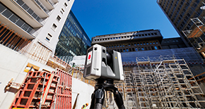
Mobile mapping systems combine vehicle-mounted hardware with intelligent software to enable fast and comprehensive data collection on the go. This opens new possibilities for service providers, from GIS data collection and HD mapping to smart city modelling and engineering analyses.
Leica Geosystems mobile mapping blends data from advanced sensors, including laser scanners, HD cameras, and GNSS, to deliver immersive detail and geo-referenced results. These technologies enable extensive mapping and produce high-accuracy data for demanding applications.
Mobile mapping systems are most successful when the workflow is streamlined with synchronised hardware and software. Our systems centralise this connection, simplifying workflows and optimising outcomes.
Intelligent software allows to plan routes and autonomously triggers data capture, making mapping simple even for complex projects. Real-time sensor fusion captures environments comprehensively, creating data that is easily transferred into office software for sophisticated processing.
Explore the Pegasus TRK portfolio, integrated software, and accessories below.
Why mobile mapping is essential for modern workflows
Data volume and quality
Capture large volumes of accurate data, ideal for detailed, large-scale projects.
Capture large volumes of accurate data, ideal for detailed, large-scale projects.
Reduced field time
Streamline surveys with faster data collection, reducing time spent on-site.
Streamline surveys with faster data collection, reducing time spent on-site.
Enhanced safety
Keep your team safe by reducing exposure to high-risk environments.
Keep your team safe by reducing exposure to high-risk environments.
Explore the portfolio

Advanced mobile mapping hardware
Leica Pegasus TRK portfolio sets the standard for advanced mobile mapping systems. Data fusion combines powerful LiDAR, positioning, and imaging sensors to deliver immersive detail and enable complex mapping projects. Discover the right Pegasus TRK for your business.

Seamlessly integrated software
Leica Pegasus FIELD and OFFICE mobile mapping software ensure smooth data collection and processing every step of the way, from planning to capturing and delivering your high-value data.

Adapt your setup with accessories
Our mobile mapping systems are built for versatility. Explore our modular sensor and power accessories, like butterfly cameras, optical DMI, power box, and more, to adapt our systems to your needs.
Grow your business with mobile mapping
Mobile mapping is an innovative technology that also enables innovative services, helping companies grow. Watch below to learn how CARRIER Géomètres Experts expanded their offerings and attracted talent using Leica Geosystems mobile mapping systems.
