


Software

Airborne Software
Leica Geosystems comprehensive airborne software plays an integral role in driving productivity across all the airborne sensor platforms.

Ilmassa käytettävä UGM 2018
Organisaatiomme seuraava käyttäjäryhmätapaaminen järjestetään Estorilissa/Lissabonissa, Portugalissa - Rekisteröidy nyt.

Leica HxMap
High-performance post-processing workflow for airborne sensors.

Leica XPro
High-efficiency production workflow for Leica ADS.
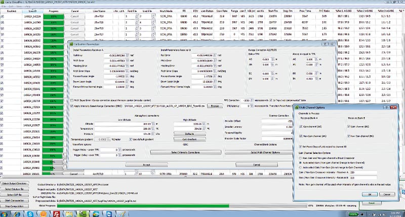
Leica CloudPro
Highly efficient point cloud post processor for Leica ALS.
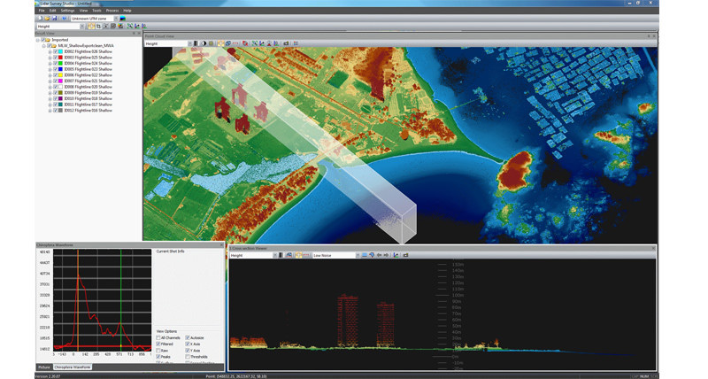
Leica LiDAR Survey Studio
Leica LiDAR Survey Studio (LSS) post-processing software suite represents a major step in sensor fusion and increased post-processing productivity.

Leica MissionPro
Advanced 3D mission planning software for all sensors systems.
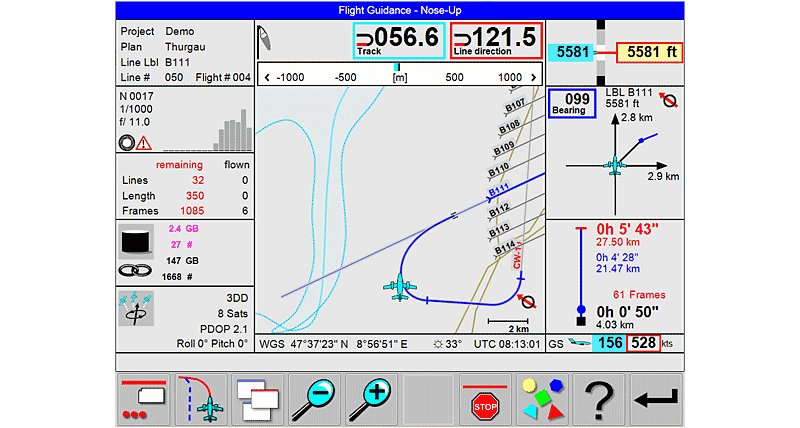
Leica FlightPro
Multisensor control software for all sensor systems.

Ilmassa käytettävien LiDAR-kartoitusratkaisujen verkkoseminaari
Tässä verkkoseminaarissa tuotepäällikkö Ron Roth kertoo lisää uuden Leica TerrainMapper-2 LiDAR-anturin tarjoamista eduista ja toiminnoista.
Tässä verkkoseminaarissa tuotepäällikkö Ron Roth kertoo lisää uuden Leica TerrainMapper-2 LiDAR-anturin tarjoamista eduista ja toiminnoista.

Ota yhteyttä Leica Geosystemsiin
Leica Geosystemsin yhteystiedot myynti-, tuki- ja teknistä tukea varten.
Leica Geosystemsin yhteystiedot myynti-, tuki- ja teknistä tukea varten.