


Building

Eiffage Construction achieves 30% higher productivity with Leica iCON and digital BIM workflows
In an ambitious project to consolidate locations for France’s Central Ministries of Labour, Health, and Solidarity, the government commissioned a new flagship site in Malakoff.
Case Study: Swissaufmass Uses Leica iCON trades
The introduction of Leica iCON trades has led to a significant increase in efficiency, with measurements now 20-30% faster. The ability to capture and transmit data digitally on-site reduces the risk of transcription errors and improves the accuracy of the results.
Digitisation of Construction: Implenia Leads with Hexagon’s Solutions
Implenia, a leading name in Swiss construction and real estate, is transforming the 30,000 m2 Kochareal district in Zurich, Switzerland, using advanced digital tools from Hexagon. This ambitious
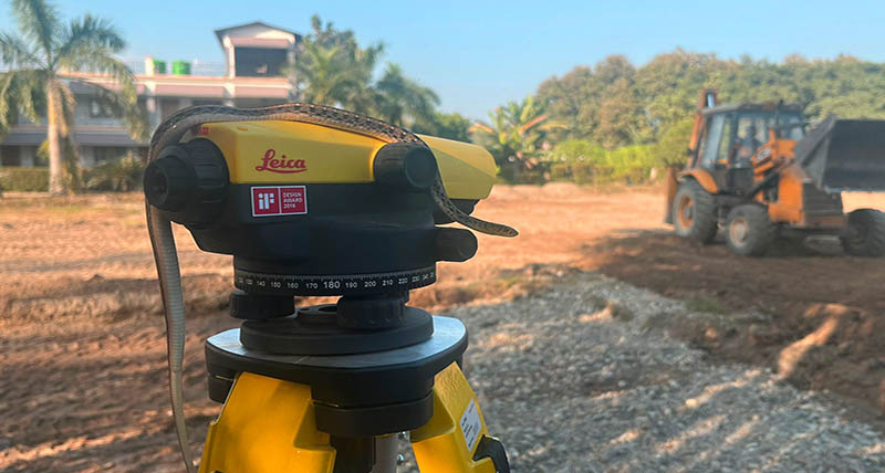
Landscaping Project in India Benefits from Leica Automatic and Rotating Laser Levels

Evolve Customer Deliverables
Solutions developed to help smaller service providers complete their work to the highest standard, increasing efficiency and accuracy.
Investing in people and technology is key to keeping up with construction industry trends
Aregger AG takes us through their ten-year journey with Leica iCON construction solutions.
Digital Construction for All: NCC works smarter and sustainably with Leica iCON
Achieving sustainability through smart project management.

Speaking with the Leaders in the Irish Survey Industry - Finnian O'Cionnaith
As part of the series ‘speaking with leaders in the Irish survey industry’, John Kerrigan (Country Manager in Ireland for Leica Geosystems) caught up with past coursemate Finnian O'Cionnaith. The pair go back twenty-four years, to when their course began in 1997. Since then, Finnian has had a truly inspirational career that’s taken him all over the world.
Sustainable and speedy: Prex Co. achieves construction goals with support from Leica iCON solutions
The Leica iCR70 robotic total station and Leica iCON build software support Prex Co. on their mission to build zero emission houses in Japan.

Laing O'Rourke - Centre of Excellence for Modern Construction
Laing O’Rourke implement laser scanning digital verification process when producing prefabricated concrete panels.
Speaking with the Leaders in the Irish Survey Industry
John Kerrigan, Country Manager in Ireland for Leica Geosystems, is on a mission to speak to leaders within the survey industry. At the top of his list was Senior Lecturer at the Technological University (TU) Dublin, Dr. Audrey Martin.
Building the large documentary facility.
Bouygues Construction is involved in the project to build the “Grand Equipment Documentary”, a large documentary facility.
Embracing The No Strings Approach | Hanham & Philp Contractors
Hanham & Philp Contractors are proud of their rich history.
Bringing BIM4ALL
A BIM firm in the Netherlands brings added values to construction customers.
Stazione totale robotica leica iCON e software, convincono per la facilità d'uso
Lavori di layout edilizio in modo più veloce, semplice e preciso nel Regno Unito.

Beyond Reality. Digital Reality’s Next Frontier
Hexagon’s Geosystems Division President Juergen Dold presented ideas and case studies where the entire planet can be digitised at HxGN LIVE in Las Vegas, USA

All set for modern living design
Digitalising construction layout for luxury residential single- and multi-family houses in the United Kingdom

Leveraging visual documentation to avoid rework
How a construction pioneer remains ahead of its time using Multivista’s visual documentation service to capture construction milestones and regular progress in the United States
Affrontare Layout impegnativi
Australia, Semplificazione dell'architettura complessa con la stazione totale robotizzata
Progettazione con misure precise
Visualizzazione dei dati in modo più semplice con misurazioni 3D usando DISTO™ S910 in Austria

Il segreto non così sorprendente di gestire con successo una società di servizi topografici
Dopo un’attività di quasi 50 anni, la Titcomb Associates continua ad alzare il livello per quanto riguarda la fornitura di servizi topografici di qualità negli Stati Uniti.
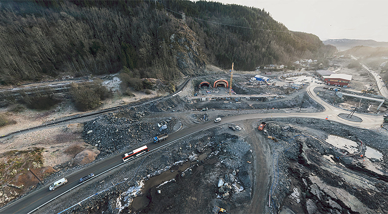
Highway construction in Norway
Using the UAV from Leica Geosystems to monitor highway construction progress, Hawkeye AS is tracking costs of mass movements, documenting progress and keeping stakeholders up-to-date.

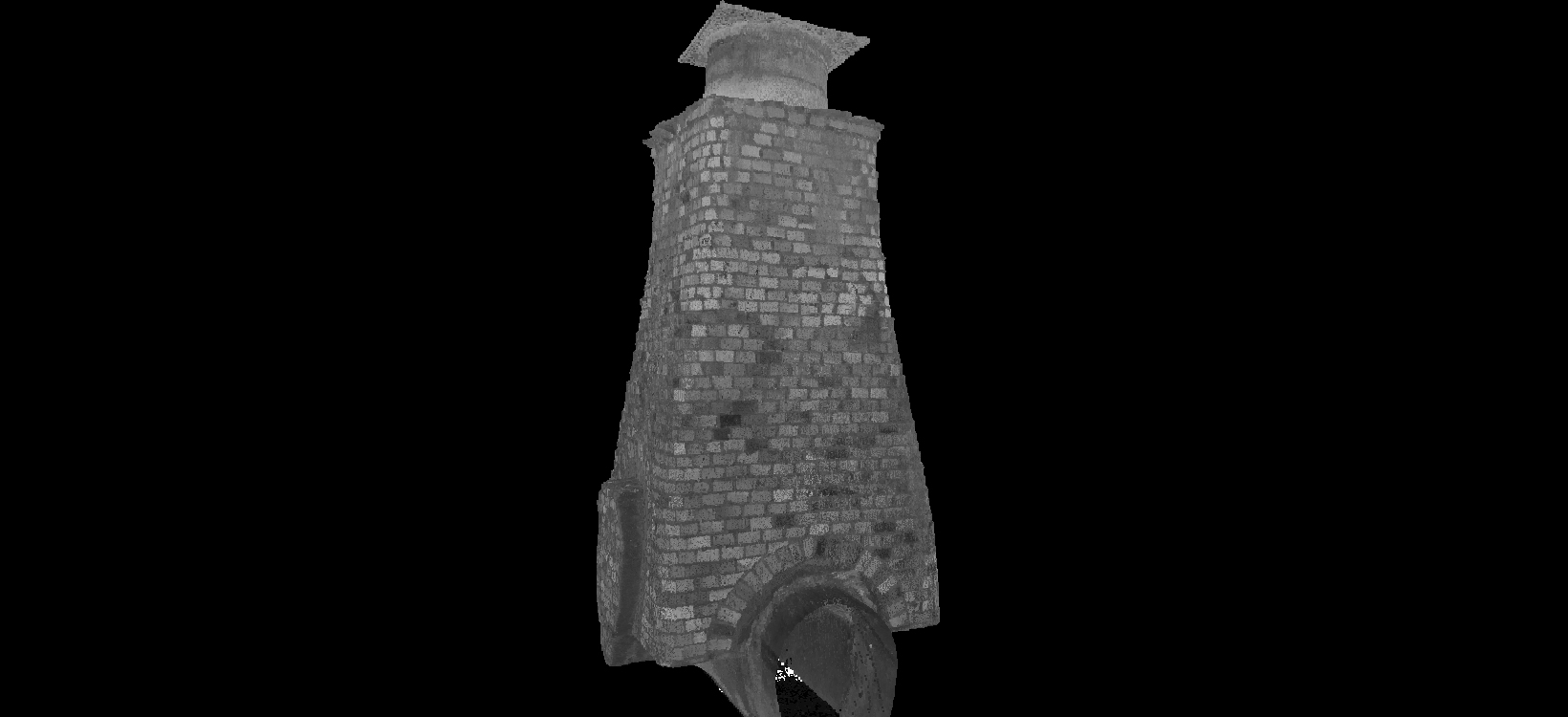
Scan 'till you drop
Renovating a shopping centre in Australia with the MultiStation.

Establishing positions with speed
Verifying construction in the USA with the iCON robot.

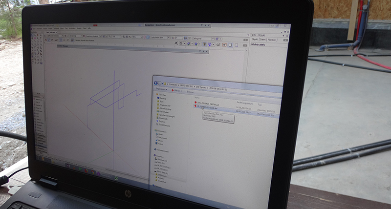
Expanding easily and accurately into the field of construction layout
Conducting building layouts in France with the iCON robot.
Monitoring of a construction site
By using Leica Geosystems UAV, it was possible to carry out a complete and accurate condition survey of the construction project every week without entering the site.
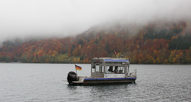
The mountain calls
Using the UAV from Leica Geosystems, IngenieurTeam GEO GmbH created the precise calculation and simulation of the actual holding capacity of a Swiss lake.
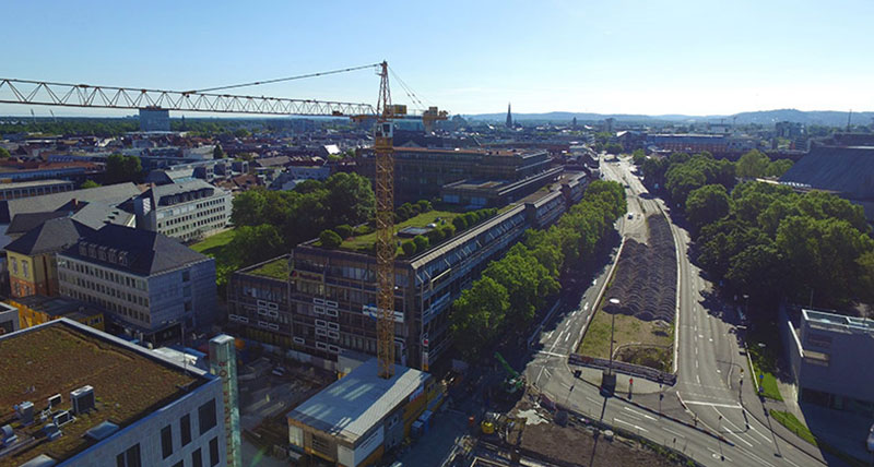
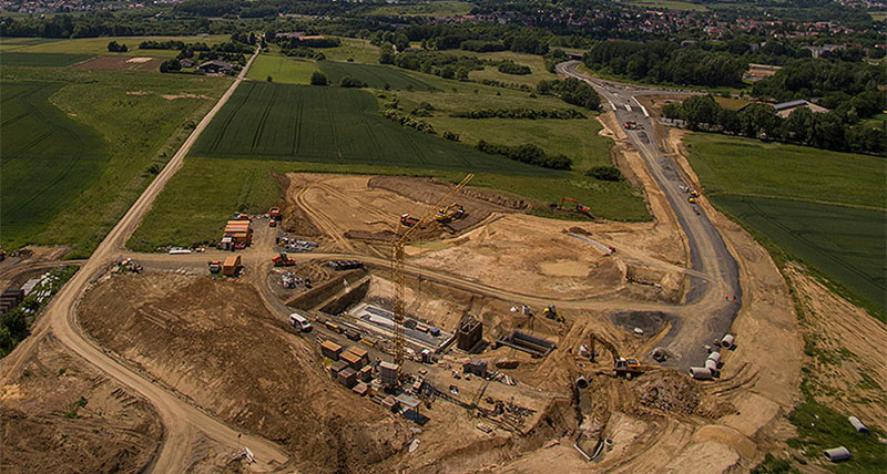
Digitising an urban construction site
Using the UAV from Leica Geosystems to monitor highway construction progress, IngenieurTeam GEO is obtaining the highest accuracy in surveying, preservation of evidence and monitoring.

Building a better future with measuring technology
Opening opportunities through vocational training, delivering drinking water and building better schools in Tanzania using Leica Geosystems’ construction tools

Contatta Leica Geosystems
Cerca il tuo referente Leica Geosystems per le vendite, il supporto e l'assistenza tecnica.
Cerca il tuo referente Leica Geosystems per le vendite, il supporto e l'assistenza tecnica.