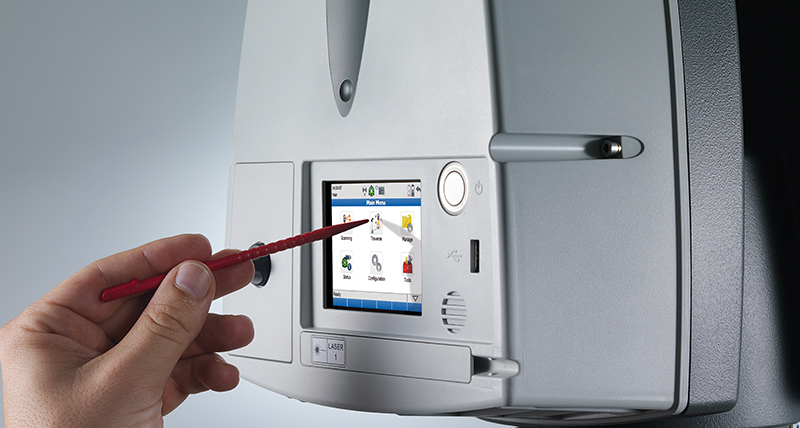
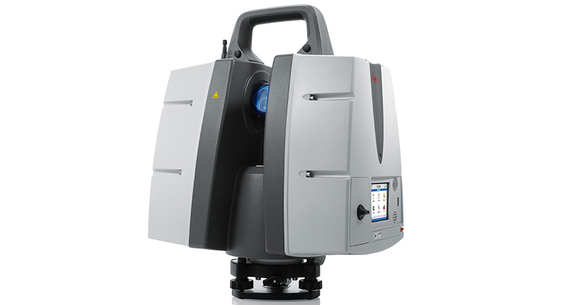
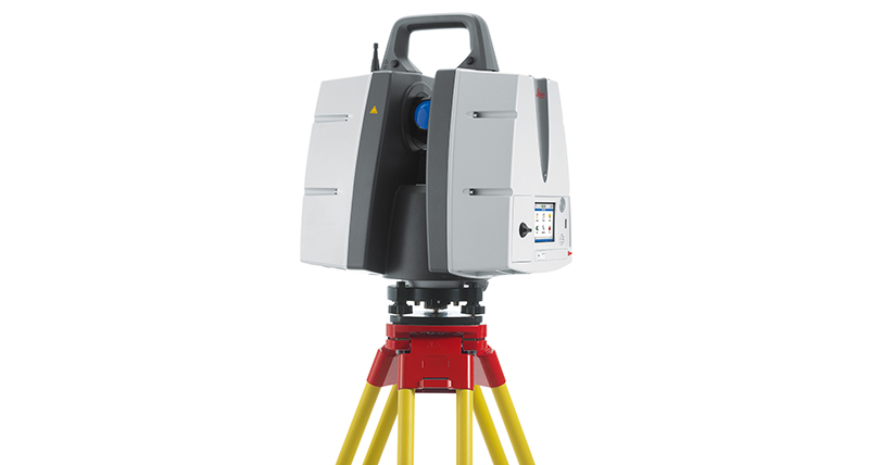
Leica ScanStation P50 – Long Range 3D Terrestrial Laser Scanner
Maximise productivity by scanning inaccessible places at a safe position on site, reducing time in the field with less setups

For industry professionals looking to scan inaccessible places and find new business opportunities, Leica ScanStation P50 is the fastest and safest, long range 3D laser scanner. Unlike any other laser scanner, the P50 solution maximises productivity by scanning inaccessible places at a safe position on site, reducing time in the field with less setups.
La scelta giusta
Per catturare in 3D gli edifici più alti del mondo, documentare gli oggetti infrastrutturali più estesi o scansionare le più grandi miniere a cielo aperto, la scansione a lunga portata è essenziale per completare lavoro. La nuova Leica ScanStation P50 aggiunge capacità di scansione a lunga portata alla gamma leader del mercato ScanStation serie-P. È una scelta ideale, perché ogni dettaglio conta.
Scansione di luoghi inaccessibili
Leica ScanStation P50 genera dati 3D di massima qualità e offre funzionalità di imaging HDR con una velocità di scansione estremamente rapida, pari a 1 milione di punti al secondo, a distanze superiori a 1 km. La straordinaria portata e l'ottima precisione angolare, abbinate a un rumore ridotto e alla compensazione biassiale per la topografia, costituiscono le basi per nuvole di punti in 3D dettagliate e mappate realisticamente.
Performance elevate nelle condizioni più difficili
L'innovativo laser scanner Leica ScanStation P50 è estremamente resistente, opera perfettamente anche nelle condizioni ambientali più difficili (come in presenza di temperature estreme da -20 °C a +50 °C) e rispetta la classificazione IP54 per resistenza a polvere e acqua.
Soluzioni di scansione complete
Leica Geosystems offre la nuova Leica ScanStation P50 come parte integrante di una soluzione di scansione completa, che comprende hardware, software, manutenzione, formazione e supporto. I dati del laser scanner possono essere elaborati con la piattaforma software per le nuvole di punti 3D leader del settore, composta dal software Leica Cyclone, Leica JetStream, dai plug-in Leica CloudWorx per i sistemi CAD Leica CloudWorx e dal software gratuito Leica TruView.
Leica ScanStation P50 offre:
- Dati 3D di alta qualità e imaging HDR
- Velocità di scansione elevatissima, pari a 1 milione di punti al secondo
- Distanze fino a 1 km
- Rumore minimo
- Compensazione biassiale per la topografia
How to use long range laser scanning
Long range 3D laser scanning
Scanning from a safe distance
PortCoast - Fighting time and tide to capture a 5-hectare coastal construction site in 3D
Portcoast - Delivering precise documentation of Port Phu My with 3D laser scanning
How does laser scanning technology transform the construction industry?
Surveying & Engineering
Exact scan of two cooling towers
Scan till you drop
Exploring the rate of climate change from deep in the Earth
Game on with laser scanning
Fitting together pieces of a puzzle
When every millimetre counts
Creating a new ski jump complex
How Hollis captures, processes, manages and delivers reality capture data
Surveying Germany's biggest aqua park
Capturing reality in one of the world's busiest airports
The full laser scan survey of a Grade II Listed historic building
Building Construction / AEC
Reality capture for BIM
From paper maps to laser scans
Speeding up BIM-reconstruction
From tape to point cloud
Using laser scanning technology for retail redevelopment
Infrastructure
Off the boat, into the air
Advancing Mexico's transportation infrastructure
Improving the railway infrastructure of a capital city
Scan, spans and automobiles
Mirroring reality for rail
Setting the world's shortest railway back on track
Protecting heritage with upgraded rail clearance
Plants & Ships
Plain sailing with 3D plant design
SOS shipbuilding on scans
Sweet success in plant documentation
Bringing safety, productivity with laser scanning
Leica Geosystems laser scanners and Hexagon PPM 3D design software access 'true reality'
Revolutionising the luxury yacht building industry with laser scanning
How Element6 delivers the future of Plant Engineering with laser scanning
Renovating complex structures with 3D laser scanning
Fighting time and tide to capture a 5-hectare coastal construction site in 3D
Public Safety
How Johnson's County is recreating crime scenes with laser scanning
Changing the game for public safety professionals with the world's fastest laser scanner
Transforming reality into photorealistic Virtual Reality with laser scanning
Heritage
The reality capture of Ellis Island
Digitising the mighty Taj Mahal
Predicting the future by analysing the past
The lower, the safer
Preserving mankind's past from mother nature's quake
Transforming Ayacucho into a digital city
Digitising Frank Lloyd Wright's desert laboratory
Digitalising the Spanish Royal Palace with laser scanning
Transforming ruins to 3D models
Preserving digitally Hukuru Miskiy
Capturing Egypt’s Sistine Chapel with the BLK360
Unveiling the mystery - an ancient water clock with laser scanning
Preserving Romania's speleological heritage with point cloud and GNSS data
Utilities
From the laser scanner to the office in near real time
Contattaci per ricevere informazioni sul mondo del laser scanner
Reality Capture Newsletter
The High-Definition Surveyor - Blog
The Power of Scanning
Quality is a tradition, built deep within our DNA. We have a commitment to excellence and exceptional attention to detail.
Quality is a tradition, built deep within our DNA. We have a commitment to excellence and exceptional attention to detail.


