


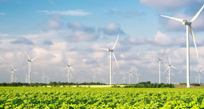


Capture and Analyse Complex Urban Environments in Detail with Mobile Scanning and Mobile Mapping Solutions
Offer a Fast, Safe, and Detailed Perspective of Complex Urban Landscapes.
Mobile scanning and mapping technologies facilitate rapid and accurate data collection. They ensure safety and accessibility by enabling remote data capture, providing crucial insights into hard-to-reach urban spaces.
Our solutions let you create 3D digital twins of cityscapes for advanced simulations and better planning. This helps make our cities better places to live and work.
Adopting mobile scanning and mapping solutions opens multiple applications in urban planning, from comprehensive topographic surveys and detailed assessments of buildings and infrastructure to enhanced disaster management planning and effective utility planning. Embrace our mobile scanning and mapping solutions to support the future of urban planning.
Best 3D laser scanning solutions for civil infrastructure
 A complete workflow
Leica Geosystems provides surveyors with the tools they need to capture, process, manage, collaborate, consume and deliver point cloud data.
Process your captured 3D scan data in the industry-leading 3D point cloud processing software Leica Cyclone.
Easily integrate point cloud data into the CAD platform of your choice with Leica CloudWorx.
Collaborate and share easy access to point cloud data for anyone in your project ecosystem with Leica TruView.
LEARN MORE
 Safely scan the inaccessible
Capture the tallest buildings or document the widest infrastructure structures at safe distances with high accuracy.
Supporting surveying workflows like traversing and resection with the ability to apply scale-factors, the P50 supports surveyors to get the highest accuracy.
Key specifications:
- 3D accuracy: 4.4mm at 50m and 6.8mm at 100m
- Scan speed: 1 mio pts/sec
- Temp range: -20°C to +50°C
- Range: Longest (70-1000m)
- Field registration: Surveying procedures
LEARN MORE
 Get the highest accuracy
Capture the 3D geometry of roads, rails, tunnels and bridges, with a laser scanner that delivers highest quality 3D data.
Supporting surveying workflows like traversing and resection with the ability to apply scale-factors, the P40 supports surveyors to get the highest accuracy.
Key specifications:
- 3D accuracy: 3.2mm at 50m and 5.9mm at 100m
- Scan speed: 1 mio pts/sec
- Temp range: -20°C to +50°C
- Range: Long (70-270m)
- Field registration: Surveying procedures
LEARN MORE
 Complete versatility
Easily step into the world of 3D scanning and capture small to mid-sized objects with the highest accuracy.
With full total station functionality, the MS60 offers complete versatility and familiarity with scanning functionality in Leica Captivate and data processing and delivering with Leica Infinity.
Key specifications:
- 3D accuracy: 2.1mm at 50m and 2.3mm at 100m
- Scan speed: up to 30,000 pts/sec
- Temp range: -20°C to +50°C
- Range: Long up to 300m
- Field registration: Total station setup
LEARN MORE
Customer Success Stories

German Engineering Office Takes Flight with BLK2FLY
GeoDocs harnessed the BLK2FLY flying laser scanner for sewer inspection projects, efficiently capturing detailed, accurate 3D data and transforming the traditionally challenging aspect of their engineering business.
GeoDocs harnessed the BLK2FLY flying laser scanner for sewer inspection projects, efficiently capturing detailed, accurate 3D data and transforming the traditionally challenging aspect of their engineering business.

How Langan Is Leading the Way with 3D Mapping
Langan enhanced its geospatial services by adopting IDS GeoRadar technology and the Pegasus TRK. The technology enabled panoramic above- and below-ground mapping for better-detailed project planning.
Langan enhanced its geospatial services by adopting IDS GeoRadar technology and the Pegasus TRK. The technology enabled panoramic above- and below-ground mapping for better-detailed project planning.

Nektar 3D Advances Transportation Engineering with AI and Mobile LiDAR
A Canadian company incorporated the Pegasus:Two Ultimate and Pegasus TRK700 Neo in transportation engineering. The technologies, coupled with GIS, accelerated transportation engineering data collection and delivery.
A Canadian company incorporated the Pegasus:Two Ultimate and Pegasus TRK700 Neo in transportation engineering. The technologies, coupled with GIS, accelerated transportation engineering data collection and delivery.
Take the leap into the future of surveying.
Download our guide to help launch your mobile portfolio.

Il tuo partner per il rilievo
Solo Leica Geosystems possiede 200 anni di esperienza nel mondo della topografia. Scopri come possiamo assisterti con le nostre soluzioni e i nostri servizi, grazie all'ampia gamma di prodotti diversificati.
Solo Leica Geosystems possiede 200 anni di esperienza nel mondo della topografia. Scopri come possiamo assisterti con le nostre soluzioni e i nostri servizi, grazie all'ampia gamma di prodotti diversificati.

Espandi il tuo business
Scopri in che modo l'utilizzo della scansione e delle nuove tecnologie possono aiutarti a creare nuove opportunità, a competere in modo più efficace e a migliorare la produttività.
Scopri in che modo l'utilizzo della scansione e delle nuove tecnologie possono aiutarti a creare nuove opportunità, a competere in modo più efficace e a migliorare la produttività.

Surveying Solutions
Regardless of how complex your task is, a solution is available within our diverse measuring, positioning and visualising portfolio to help you collaborate, be more efficient and succeed.
Regardless of how complex your task is, a solution is available within our diverse measuring, positioning and visualising portfolio to help you collaborate, be more efficient and succeed.

Migliora le tue abilità
Acquisire abilità per essere più efficienti e reagire alle opportunità di business. Libera il tuo potenziale per offrire ai tuoi clienti servizi migliori, più specializzati e più rapidi.
Acquisire abilità per essere più efficienti e reagire alle opportunità di business. Libera il tuo potenziale per offrire ai tuoi clienti servizi migliori, più specializzati e più rapidi.