


Reporter 88
Reporter, customer magazine – INTERGEO 2020

President’s Message
Many industries and companies describe 2020 as a “lost” year. We definitely do not! Though this year has dramatic humanitarian and economic challenges affecting us all, requiring a lot of flexibility and adaptability, we also see countless impressive success stories from our customers.
Throughout our long history, we have overcome many external market changes and technology changes, all while keeping a high pace of innovation. Customers are the focus, and we strive to never let them down. I have been able to participate in various leadership positions during the past 17 years, and now, as president of Hexagon’s Geosystems division, I present you my first Reporter President’s Message with a dedicated focus on the digitalisation boost, which industries are experiencing right now.
For a long time, and now reinforced, we are experiencing a digital acceleration within the industries. Companies are on a journey using digitalisation to automate tasks and quickly bringing all relevant stakeholders together in ecosystems, which lead to autonomous solutions. It is impressive how customers use our solutions to digitise their business models. In this edition of Reporter, we present companies that have left traditional paths and are successfully treading new ways in order to strengthen their competitive advantage.
Surveying methods enable digitalisation of real estate. Hollis, a leading firm of independent real estate consultants in the U.K., use Leica Geosystems 3D laser scanners and software to digitalise commercial and residential properties. The reality capture experts now manage vast amounts of digital data making it accessible across the company so CAD work can begin sooner. With point cloud registration times minimised, the firm delivers final scans to clients quicker and more cost-effectively.
Building construction benefits from streamlined workflows and faster interaction with customers. Kolb GmbH, a scaffolding provider in Germany, has modernised its consultation workflow with the Leica BLK3D real-time 3D measurement solution. Automating measurements on handheld devices, the company has reduced its time on sites by more than 80%. By connecting the field data to technicians back in the office, the company is now able to provide fast quotations.
Heavy construction historically has been a digitally underserved industry. Al Nisr, a world leader in the construction of airfields and supporting infrastructure in the UAE, turned to Leica iCON 3D machine control solutions to create digital construction sites that connected all project stakeholders. Moving to stringless paving, the company automated stakeout procedures while tripling its capacity length in paving airstrips and cutting project times in half.
HxGN Content Program supports automating tasks with maturing technologies, such as Artificial Intelligence (AI). These technologies, though, rely on consistent information to feed and train algorithms. With imagery being collected on a regular schedule and providing normalised datasets, the HxGN Content Program enables advanced analytics and automatic updates of location-based information. Updates are then performed efficiently, leading to automation of tasks like change detection.
The digitalisation journey is gaining speed and the momentum of the “next normal” will accelerate the convergence of real and digital worlds into autonomous solutions, providing and creating business opportunities. At Geosystems, experiencing the digitalisation boost ourselves, we will continue to strengthen our customers with innovative sensor and software solutions to lead by example and demonstrate what can be done. Join us in co-creating an autonomous future.
Have an interesting and enjoyable read.

Thomas Harring
President, Hexagon's Geosystems division
Read our customer stories here:
THOUGHT LEADERSHIP

Tworzenie inteligentnych rzeczywistości cyfrowych za pomocą funkcji przechwytywania rzeczywistości
Fuzja czujników w celu stworzenia najnowszej platformy wizualizacji cyfrowej rzeczywistości, HxDR.

Pomiary dla robota budowlanego - prawdziwa współpraca człowieka z maszyną
Co automatyzacja w budownictwie przyniesie geodetom? Wraz z rosnącymi oczekiwaniami dotyczącymi lepszego projektowania i szybszego budowania, prawdopodobnie pojawi się wiele możliwości dla firm geodezyjnych świadczących usługi dla firm budowlanych.

Paving the Road to Real-time Change Modelling
Changing mapping to keep up with an ever-evolving world.

How a Building Solutions Portfolio Supports Your Journey Toward Digitalisation
Introducing Building Solutions portfolio.

Surprising Facts About #dirtsimple Mute Digital Twins
How to build digital twins and why construction professionals would need them? Learn more how IoT transforms the heavy construction industry.

Why the BMT Acquisition Changes Everything
Hexagon recently acquired Blast Movement Technologies, the latest in a string of acquisitions by the company but potentially the most significant for the industry in years.
WHAT'S NEW

News
Latest Geosystems happenings

Measure What You See — How New GNSS Technology is Helping Surveyors Improve Efficiency
The Leica GS18 I is a GNSS RTK rover that enables you to measure hundreds of survey-grade points in minutes from a safe distance. It allows you to capture the site and measure from the images in the field or later in the office — whatever is best for your task at hand

Integrating Slope Stability Monitoring with Mine Operations
Integration between IDS GeoRadar and Hexagon’s MineProtect portfolio now connects systems for safety and radar-based slope stability hazards.
AROUND THE WORLD
Our Customers
Around the world. Every day. Any application.
SURVEY SOLUTIONS APPLICATIONS

How Hollis Captures, Processes, Manages and Delivers Reality Capture data
From data collection to delivery, building consultancy firm Hollis used a full end-to-end Leica Geosystems solution to capture and model a 16,000-square-metre building in the United Kingdom.

Ochrona dziedzictwa speleologicznego Rumunii za pomocą chmury punktów i danych GNSS
Skanowanie laserowe 3D i odbiorniki GNSS posłużyły do wygenerowania danych wykorzystanych do badania jaskini o długości 6 298 metrów w Rumunii i zarządzania nią

Walka z czasem i pływami podczas skanowania w 3D 5-hektarowego przybrzeżnego placu budowy
Wykorzystanie skanowania laserowego 3D do wizualizacji portu Hyosung Vina Chemicals w Wietnamie.

Surveying Germany’s Biggest Aqua Park
By expanding his surveying portfolio, Keller has been able to provide all surveying services for the plan and construction of a water park in Germany
HxGN Content Program Enables Machine Learning, Advanced Analytics
Providing consistency for algorithms with the HxGN Content Program.
Simultaneous Capturing of LiDAR and Imagery
Collecting LiDAR and multispectral data of urban areas with the Leica CityMapper in the United Kingdom.
5G Wireless Network Design Relies on 3D Aerial Data
Reaching 5G in the United States with the HxGN Content Program.
BUILDING SOLUTIONS APPLICATIONS

Great Increase in Efficiency for Scaffolders
With the BLK3D, only a few minutes are needed on site to gather all the required measurement data increasing the number of different site visits per day.

Bringing BIM4ALL
A BIM firm in the Netherlands brings added values to construction customers.
iCON Robotic Total Station and Build Software Convince with Ease of Use
Executing construction layout tasks much faster, simpler and more accurately in the United Kingdom
HEAVY CONSTRUCTION APPLICATIONS

An invitation into the Piling Rig Cabin of Henrik Bergman
Piling rig operator Henrik Bergman describes his working experiences with machine control for piling rigs in Sweden.

Drilling in Norway with 3D Rig Solution
3D machine control solution for rig applications enables operators to work more efficiently and from a safe distance in Norway.

Proste układanie nawierzchni - od sznurków po kompletne rozwiązanie do sterowania maszynami 3D
Rozwiązanie do układania nawierzchni sterowane maszyną 3D pomaga wykonawcy ukończyć 12-miesięczny projekt budowy lotniska w Zjednoczonych Emiratach Arabskich w ciągu sześciu miesięcy.
MINING APPLICATIONS
Mastering the Tricky Art of Responsible Waste Planning
In the South Pacific islands of New Caledonia, MinePlan Schedule Optimiser and
3D software are being used to manage waste responsibly and help preserve a UNESCO World Heritage Site.

How Cerrejón Tackles Risks and Prevents Accidents
A Hexagon film crew visited Colombia to document Cerrejón’s commitment to safety.

Maximising Profits with Fragmentation Analysis
How fragmentation analysis solution saved one mine in Peru $7.2 million a month.

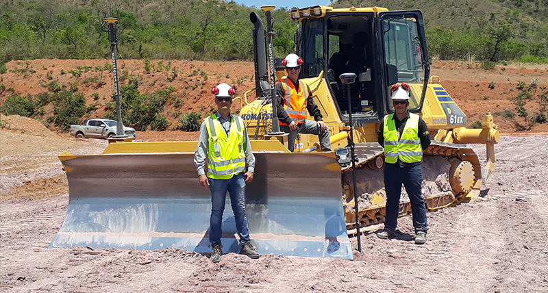
Around the world
Customers across the globe solving complex daily challenges using Leica Geosystems equipment
Customers across the globe solving complex daily challenges using Leica Geosystems equipment

Nasze najnowsze wiadomości
Dowiedz się o najnowszych wydarzeniach związanych z markami Leica Geosystems.
Dowiedz się o najnowszych wydarzeniach związanych z markami Leica Geosystems.

Kontakt z Leica Geosystems
Chcesz dowiedzieć się więcej? Jesteśmy tutaj, aby odpowiedzieć na Twoje pytania.
Chcesz dowiedzieć się więcej? Jesteśmy tutaj, aby odpowiedzieć na Twoje pytania.